SDG 13.3.4
SDG 13.3.4 Inform and support government
1. NCUE faculty members take part in research and practice projects that address the challenges of global warming and climate change. Through climate research, environmental surveys, long-term monitoring, remote sensing analysis, and local practice, they track climate and environmental change and related disaster risks, and provide research results and monitoring data to local and central governments to support the identification, monitoring, and early warning of climate-related disaster risks, as well as environmental management and adaptation planning. The related projects, listed in Table 1, cover large-scale circulation and precipitation change under global warming, changes in Changhua's coastal topography and aquaculture environment, sediment disaster risk, landscapes and slope disasters on Bagua Mountain, coastal wetland social-ecological systems, and weather and air quality monitoring. Through University Social Responsibility (USR) Projects, local environmental education, and community capacity building, NCUE also strengthens local awareness and monitoring of climate change and environmental risks. Through interdisciplinary research and collaboration with governments and local communities, NCUE has built a pathway from scientific research, environmental monitoring, and risk assessment to information provision and decision support, helping governments understand climate and environmental risks and informing related planning and management.
Table 1. Related Projects
| No. | Project Name |
|---|---|
| 1 | Impacts of Large-scale Circulation Changes on Precipitation in the Asian Monsoon Region under Global Warming (III) |
| 2 | Monitoring Geomorphic Change and Environmental Controls of the Tidal Flat in the Changhua Coast Using Multi-scale Remote Sensing (Sub-project 1) (III) |
| 3 | 2025 Spatial Information Collection, Interpretation, and Change Analysis of Sediment-Related Disasters |
| 4 | 2025 Changhua County Landscape Conservation Promotion Program |
| 5 | Long-Term Socio-Ecological Core Observatory: Monitoring of the Coastal Wetland Agro-Fishery Socio-Ecological System in Western Taiwan |
| 6 | University Social Responsibility (USR) Project: "Ecological Healing and Green Sustainability: Changhua Ecological Art Project" |
| 7 | Resilient Changbin: Climate Change and the Sustainability of Changhua's Coastal Environment and Industries |
2. Project content descriptions are as follows:
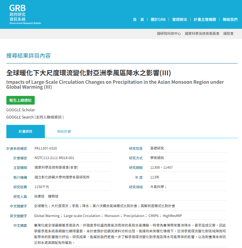
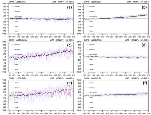
(1) Impacts of Large-scale Circulation Changes on Precipitation in the Asian Monsoon Region under Global Warming (III).
(a) Government Research Bulletin (GRB) (Figure 1): https://www.grb.gov.tw/search/planDetail?id=16551737
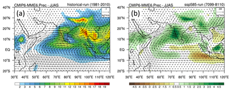
(b) This study primarily investigates the long-term seasonal changes in precipitation and moisture flux across different seasons over the South Asian and East Asian monsoon regions under future warming scenarios. The results indicate that, driven by the continuous rise in global temperatures, atmospheric moisture content increases significantly in both the East Asian and South Asian monsoon domains. In terms of water vapor flux, increased northward transport from the Bay of Bengal during the spring enhances precipitation over the southeastern Tibetan Plateau and the mountainous regions of Northeast India. During the monsoon season, rainfall over the Indian Peninsula increases substantially, facilitated by a robust cross-equatorial flow. This flow transports vast amounts of moisture from the Southern Hemisphere across the equator, traversing the Arabian Sea, the Indian Peninsula, and the Bay of Bengal, before advancing eastward into Indochina and northward to the southern margin of the Tibetan Plateau, where it triggers heavy precipitation. In autumn, the Somali Jet, which typically weakens during this transition, maintains its intensity for moisture transport, and coupled with an anomalous cyclonic circulation, results in increased rainfall across South Asia. Within the East Asian monsoon system during the plum rain and typhoon seasons, precipitation increases over the coastal regions of eastern China and Taiwan. This is attributed to a distinct water vapor flux originating from the Bay of Bengal and moving northward through Indochina and the South China Sea into these regions, accompanied by anomalous vertical ascending motion that further enhances regional rainfall (as shown in Figures 2-3).
(2) Monitoring Geomorphic Change and Environmental Controls of the Tidal Flat in the Changhua Coast Using Multi-scale Remote Sensing (Sub-project 1) (III)
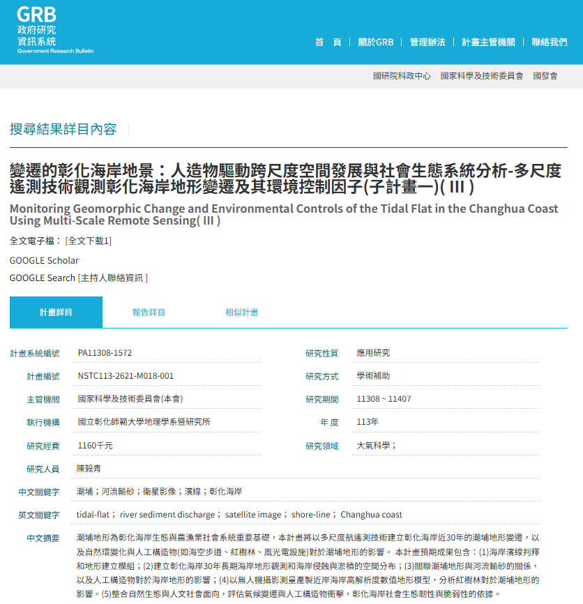
(a) Government Research Bulletin (GRB) (Figure 4): https://www.grb.gov.tw/search/planDetail?id=16727418
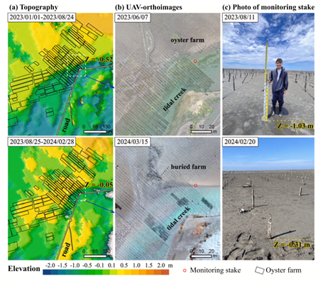
(b) The Changhua coast has the largest intertidal wetland in Taiwan, with tidal flats extending 4–5 km at low tide. The flats are an important ecological habitat and the basis of the oyster farming industries of Hanbao, Wanggong, and Fangyuan. In recent years, reduced river sediment supply, disturbance from artificial structures such as harbor jetties and the Sea Cow Trail, and sea level rise and extreme weather under climate change have rapidly altered tidal flat topography and continue to shrink the area available for aquaculture.
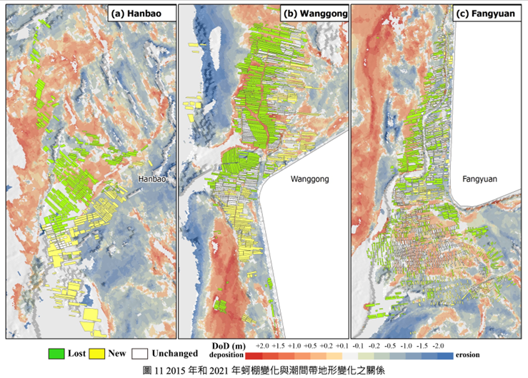
The project used multi-scale remote sensing to monitor topographic change on the tidal flats of the Changhua coast. It collected 299 Landsat and Sentinel-2 images from 2015–2024 and, combined with tide level data from Taichung Port, developed the LogiTide2DEM logistic regression model to reconstruct annual intertidal topography (published in an SCI journal). Oyster rack distribution was mapped through drone photogrammetry and aerial photo interpretation. From 2015 to 2021, oyster racks decreased from 2,814 (198.87 hectares) to 1,714 (130.54 hectares), mainly because of landward sandbar migration and tidal channel shifts. Oyster racks are best placed on tidal flats at elevations of −0.6 to +0.4 m that are submerged for about half of each day; in 2023, the eastward migration of a sandbar reduced the area suitable for oyster farming by about one-third.
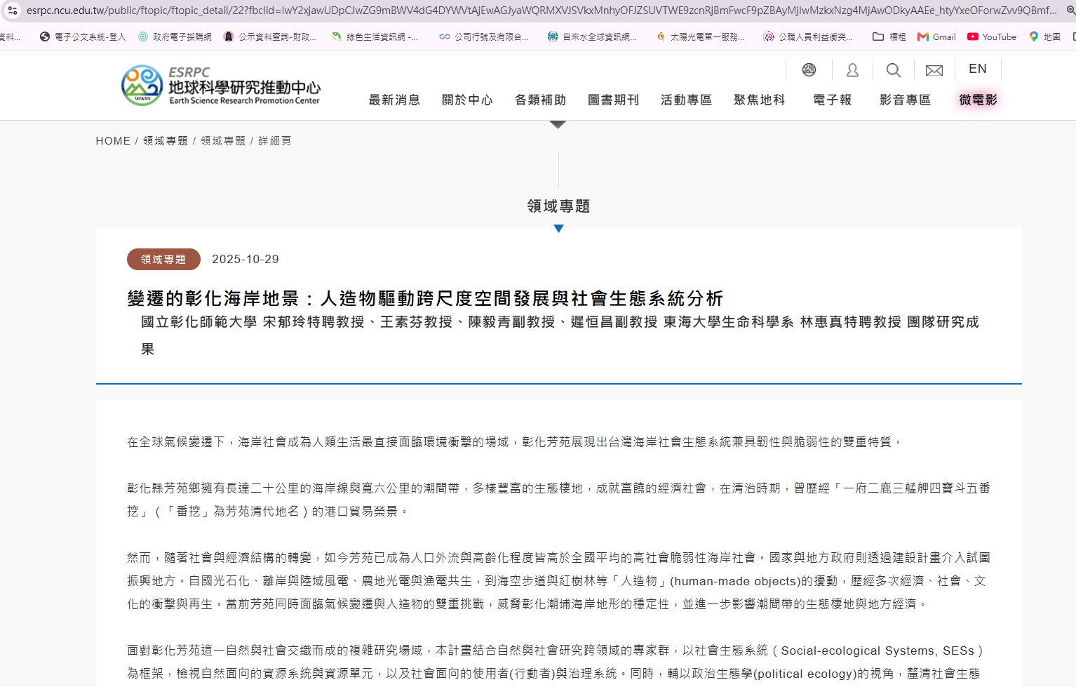
The long-term coastal topographic monitoring methods and data developed by the project can help water resources and fisheries authorities and local governments monitor coastal change risks, adjust aquaculture areas, and plan climate adaptation. Combined with local interviews conducted by Sub-project 6, the project links geomorphological science with the adaptation experience of coastal communities (Figures 5–6). Related webpage is shown in Figure 7 (URL: https://esrpc.ncu.edu.tw/public/ftopic/ftopic_detail/22?fbclid=IwY2xjawUDpCJwZG9mBWV4dG4DYWVtAjEwAGJyaWQRMXVJSVkxMnhyOFJZSUVTWE9zcnRjBmFwcF9pZBAyMjIwMzkxNzg4MjAwODkyAAEe_htyYxeOForwZvv9QBmfUiqexBygdXGg96gFyOG9W7UILCGSSIfCmU21PaA_aem_2p1Z05v_Gtqi3ZgKvd1alg)
(3) NCUE Department of Geography's 2025 Project on Spatial Information Collection, Interpretation, and Change Analysis of Sediment-Related Disasters
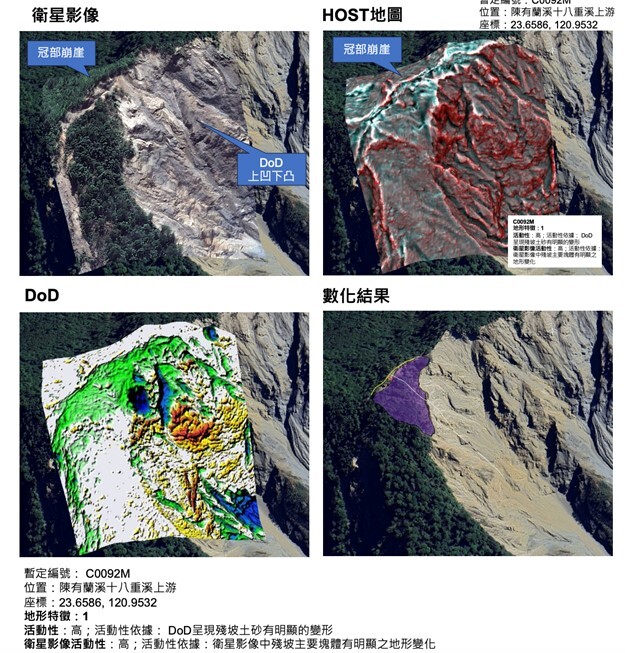
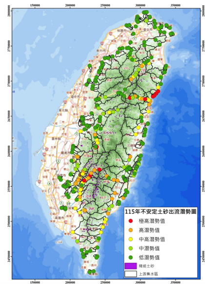
Commissioned by the Agency of Rural Development and Soil and Water Conservation, Ministry of Agriculture, this project uses multi-scale remote sensing for emergency interpretation, topographic change monitoring, and risk assessment of sediment-related disasters across Taiwan, directly supporting government disaster prevention and reconstruction. In 2025, the project covered nine disaster events: the January 21 and January 30 earthquakes; the June 13, July 21, July 28, and October 20 heavy rainfall events; and Typhoons Danas, Wipha, Podul, and Ragasa. The team compared pre- and post-disaster multi-temporal satellite images from Sentinel-2, PlanetScope, Pleiades, and SkySat and interpreted 1,260 disaster sites during the emergency phase, providing a basis for rapid assessment of disaster extent and recovery planning. Using SPOT imagery, the team also built the 2024 nationwide landslide map layer with 37,669 landslide records, calculated landslide area and landslide ratio by watershed, and delineated landslide severity zones as a scientific basis for sediment disaster risk assessment and priority management of high-risk areas. In addition, unmanned aerial vehicles captured high-resolution images of 14 areas covering 36.26 square kilometers to produce orthophotos and digital surface models. The team delineated residual slopes, estimated unstable sediment volumes and risk levels, quantified in-channel sediment deposition, and identified high-risk river reaches. The resulting potential map of unstable sediment in watersheds supports the competent authority and its branches in disaster prevention planning, river dredging, and watershed management, strengthening early warning and response to extreme rainfall and typhoons (Figures 8–9).
(4) NCUE Department of Geography's 2025 Changhua County Landscape Conservation Promotion Program: Providing Landscape Disaster Risk Information and Environmental Management Support to Government
Funded by the Changhua County Government and guided by the Forestry and Nature Conservation Agency, Ministry of Agriculture, this program inventories potential natural landscape and natural monument sites on Bagua Mountain in Changhua each year. In 2025, the program focused on the southern section of Bagua Mountain. Using literature review, field surveys, and drone photography, the team inventoried and documented 10 potential landscape sites, including the Longzaitou Mountain badlands, the badlands at the southern foot of Bagua Mountain, the Songbaikeng gravel beds, the Toutiaokeng landslide scarp and debris flow gullies, four alluvial fans in the southern section of Bagua Mountain, and the knife-edge ridges of Tianzhong and Puzhong.
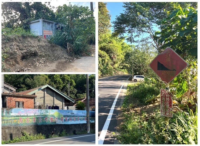
For each site, the team recorded strata, structures, and landforms and assessed conservation status, types of threats, and potential hazards. The survey found that gravels of the Toukoshan Formation in the southern section of Bagua Mountain are weakly cemented and that slopes are highly sensitive to heavy rain. After heavy rainfall, sediment often moves down erosion gullies onto lower slopes and roads, and the risk of landslides and debris flows remains (Figure 10). The program included the survey and risk assessment data in its final report for the Changhua County Government and the Forestry and Nature Conservation Agency as a reference for future development management, environmental education, and landscape conservation. By providing local landscape survey and risk information, the program supports government environmental management and the identification of climate-related disaster risks.
The program also held 4 landscape conservation outreach activities (Figure 11): two "Mineral and Rock Replica Soap Workshop" sessions on October 18, 2025 (28 participants) and two "Landscape Bonsai Making and Stories of Bagua Mountain" sessions on October 24 (19 participants), with 47 participants in total. These activities increased residents' understanding of Bagua Mountain's red-soil gravel beds, geological and topographic features, and slope environments.
(5) Long-Term Socio-Ecological Core Observatory: Monitoring of the Coastal Wetland Agro-Fishery Socio-Ecological System in Western Taiwan
(a) Government Research Information System (Figure 12): https://www.grb.gov.tw/search/planDetail?id=17132541
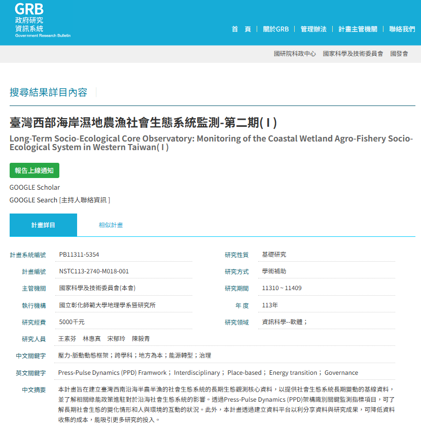
(b) The project builds core long-term observation data on the semi-agricultural, semi-fishing social-ecological system of Taiwan's southwestern coast. With Fangyuan as its core site, it conducts place-based demonstration research to provide baseline data on long-term social-ecological change and to understand how green energy policies affect coastal social-ecological systems. Using the Press-Pulse Dynamics (PPD) framework to identify key monitoring indicators, the project tracks long-term social-ecological change and human–environment interactions.
(c) Establishing the Long-Term Social-Ecological Research (LTSER) Changhua Station
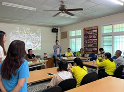
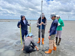
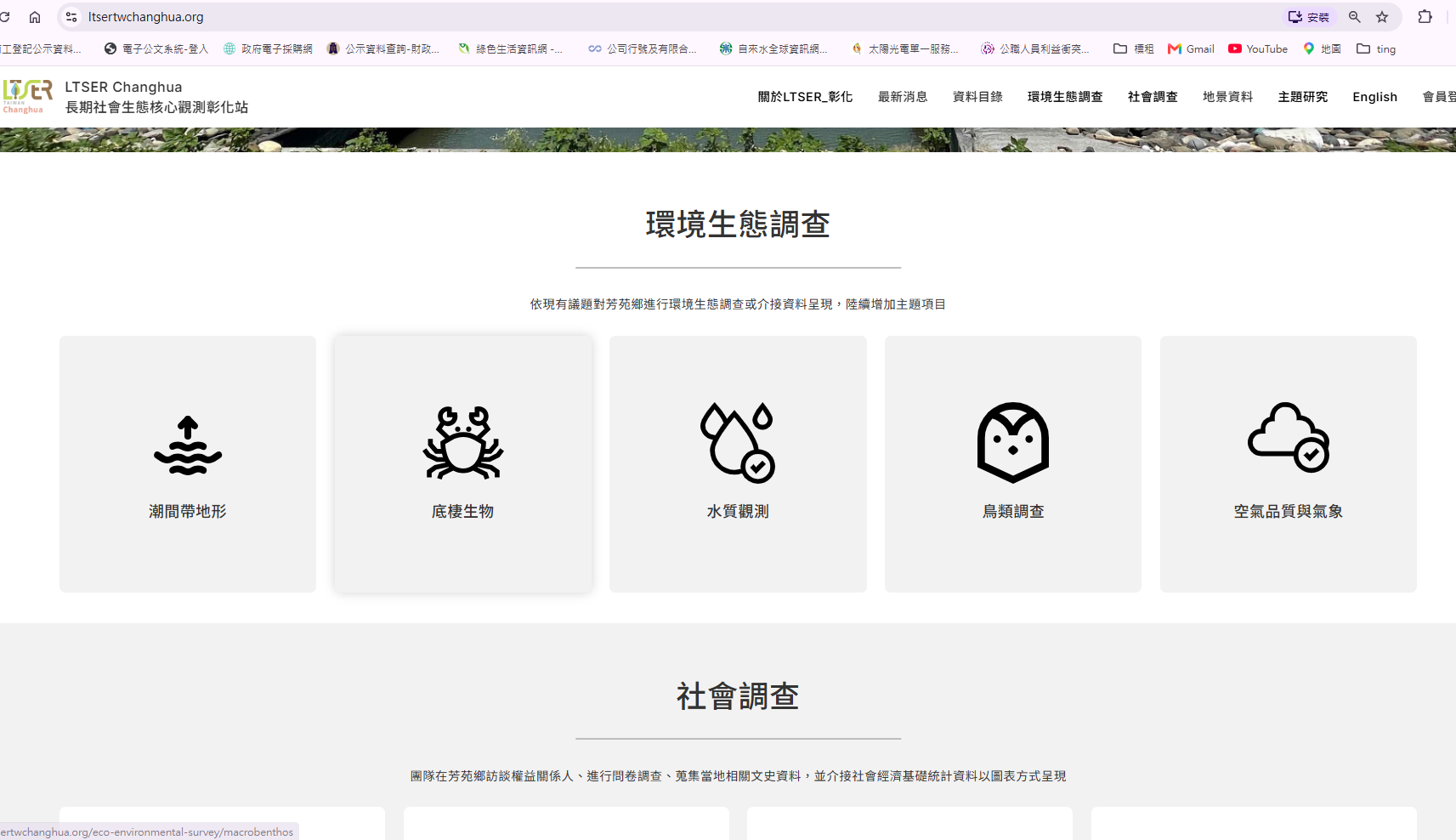
The station conducts water quality, ecological, and topographic surveys at Fangyuan, Hanbao, and Wanggong Wetlands and will continue this monitoring. In-depth interviews with key local stakeholders form an important part of the station's social data and help expand the platform's local networks. Information on stakeholders' roles, functions, and interests, and on their experience of combined social and ecological change, is systematically organized and collected as a core social-ecological dataset for the LTSER platform. Based on these interviews and local documents, the station designs questionnaires to learn how residents perceive environmental and green energy issues. Station staff also take part in local activities to identify emerging issues and work with local partners so that long-term observation data can respond to local needs. Photos are shown in Figures 13–14. LTSER Changhua Station webpage is shown in Figure 15. (https://www.ltsertwchanghua.org/about/background-and-purposes)
(6) "Ecological Healing and Green Sustainability: Changhua Ecological Art Project"
In response to the ecological crisis caused by global warming, NCUE's Department of Fine Arts launched the 2025–2027 USR project "Ecological Healing and Green Sustainability: Changhua Ecological Art Project." With local care as its main theme, the project supports UN SDG 13 (Climate Action).
(a) The project links teaching sites at the university, secondary, and elementary levels to advance inter-school environmental education and ecological restoration. Activities include workshops for elementary and secondary school teacher communities, the outdoor "Planting, Covering, Planting" performance at Changhua County Changhua Arts Senior High School, the NCUE × Providence University joint exhibition "A Travel Guide for Grey-faced Buzzards: Encounters in Four Seasons," and a campus ecological garden built with Tainan National University of the Arts. By sharing teaching outcomes, field observations, and ecological resources, the project helps build local networks for climate change education and ecological conservation and offers a model for sustainable environmental governance on campuses and in communities.
(b) NCUE held a series of activities, including "Forest Breathing Together," "Spirits in the Wind: Grey-faced Buzzard Ecological Observation," and "Riding the Wind: An Eco-Tour of Purple Crow Butterflies and Grey-faced Buzzards," combining ecological observation, species migration, and nature exploration to show faculty, students, and residents how climate change affects habitats and ecosystems. The accumulated local ecological observations support ecological education and environmental conservation, deepen the inter-university "Ecological Geography" collaboration among USR projects in central Taiwan, and increase public participation in conservation and climate action.
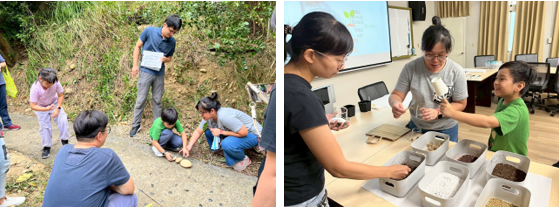
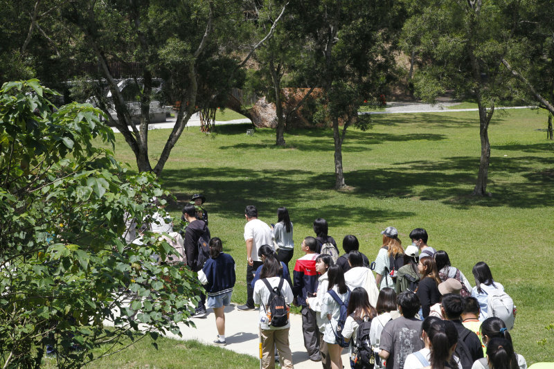
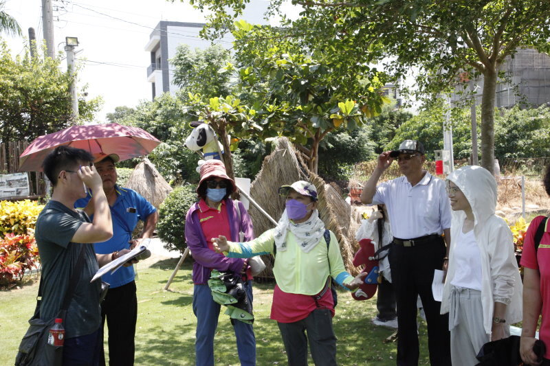
(c) NCUE and the Siangshan Community Development Association co-organized 9 local ecological training sessions, including the "Siangshan Community Ecological Survey Workshop," the "Changhua Environment and Climate Change Seminar," and "Eastern Park Ecological Guiding Capacity Building Training." Through local field surveys, ecological monitoring, and guided tour practice, community volunteers developed skills in environmental observation, ecological interpretation, and climate change education. The courses provide a foundation for community environmental education and conservation outreach and establish a mechanism for ongoing local monitoring and feedback, strengthening local environmental governance and community resilience to climate change (Figures 16–17).
(7) Resilient Changbin: Climate Change and the Sustainability of Changhua's Coastal Environment and Industries
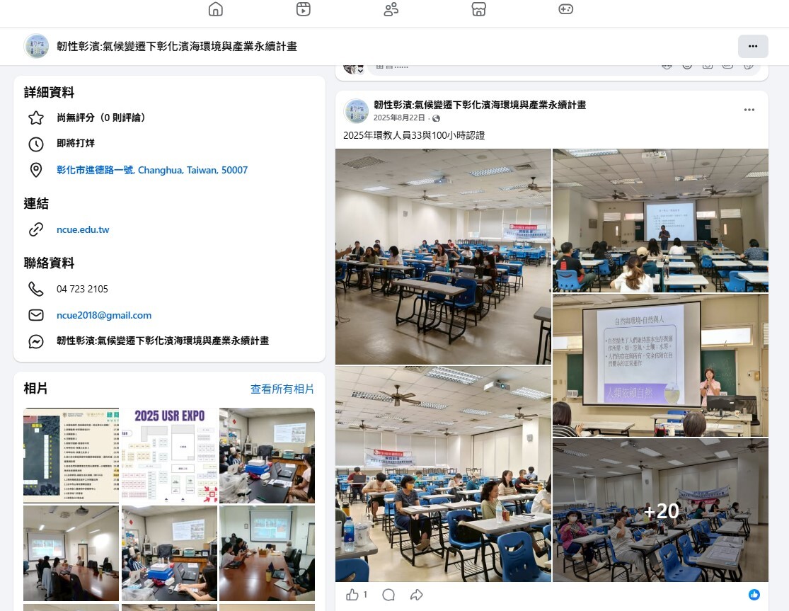
Through the Resilient Changbin project, NCUE uses Changhua's coastal area as a field site for local education on climate change risks, environmental impacts, mitigation, and adaptation. The project draws on expertise in biology, ecology, aquaculture, geography, environmental education, and information technology. It offers 18 interdisciplinary courses and runs 24-, 33-, and 100-hour environmental educator certification courses on climate change as well as carbon inventory courses, integrating climate topics into teaching and local practice. The project also formed a Water Quality Testing Team to help aquaculture farmers monitor changes in water quality, trained 91 intertidal citizen scientists to monitor intertidal zones and wetlands, and held 4 marine camps and educational activities on blue carbon, marine conservation, wetlands, water quality, net-zero emissions, and carbon footprints. These efforts turn climate change, ecological conservation, and local industry issues into environmental education that communities can take part in, developing local climate action leaders and strengthening local climate adaptation and environmental resilience.
Project activity webpage is shown in Figure 18. (URL:https://www.facebook.com/NCUEUSR/)
3. Seismic and Meteorological Observation Networks
Taiwan is located at the boundary of the ‘Eurasian Plate’ and the ‘Philippine Sea Plate’, so earthquakes are very frequent. According to data of the Seismological Center, Central Weather Administration, from 1991 to 2015, about 3,000 earthquakes occurred in Taiwan every month on average, and 102 major earthquake-related disasters occurred from 1901 to 2016. Although accurate earthquake prediction is not yet possible, the growing body of seismic observation data helps improve disaster relief efficiency and reduce loss of life and property. In cooperation with the Central Weather Administration, NCUE has installed strong-motion and other observation instruments on both campuses and in the faculty housing area, set up the Baisha Weather Station, and built a real-time weather and disaster monitoring system.
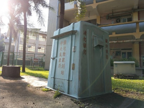
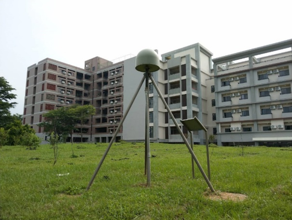
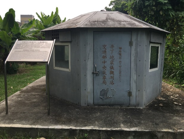
(1) Below are some more details about the seismic observation apparatuses (Figures 19-21).
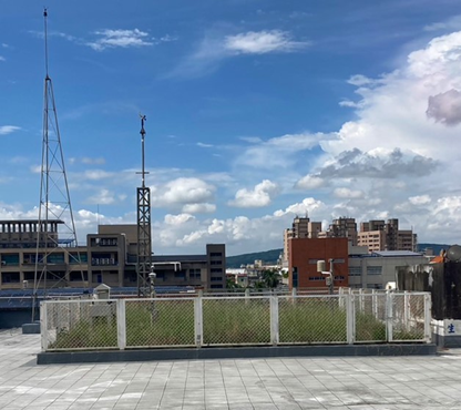
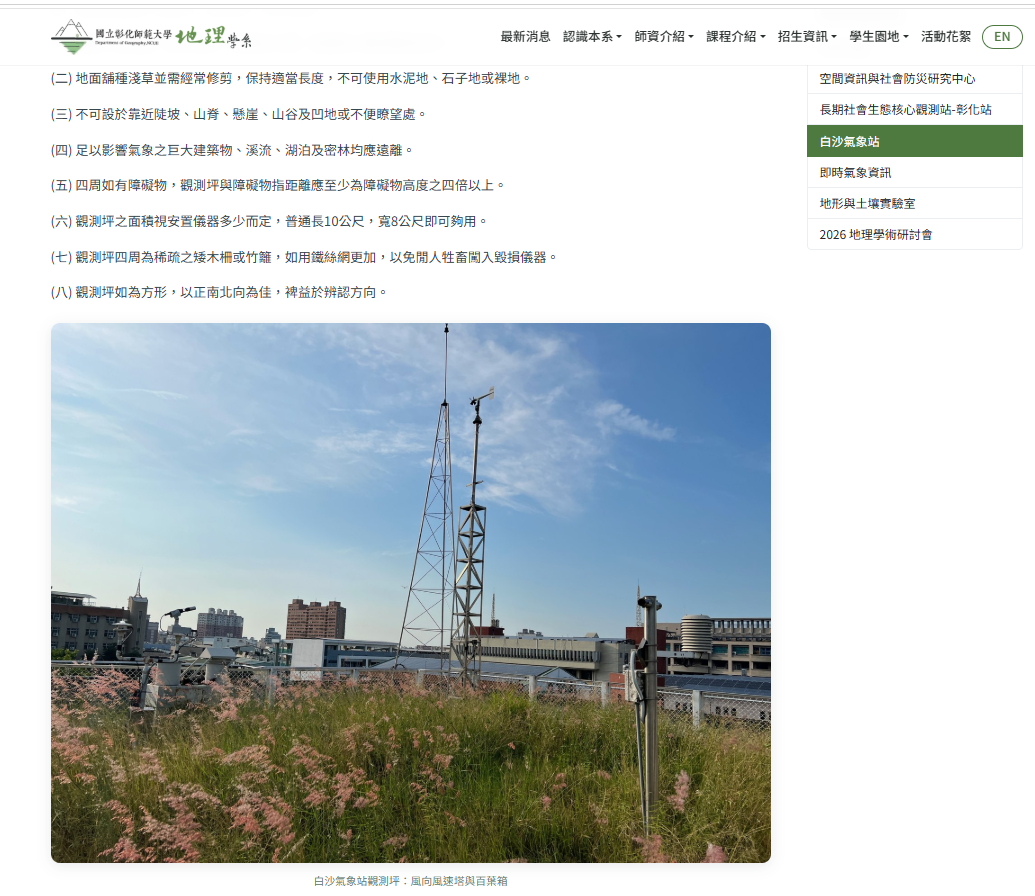
(2) To build partnerships with academia, the Central Weather Administration (CWA) cooperates with several universities in Taiwan through industry–academia cooperation, providing students with practical training sites. The automatic weather station operated by NCUE's Department of Geography is one of these sites and the only partner station at a university in central Taiwan. The station, located on the rooftop of the Department of Geography building, began operation in November 1997 and entered its 28th year in 2025 (Figure 22). Its meteorological instruments and peripheral equipment make real-time observations, and the data are transmitted to the CWA's Southern Region Weather Center for compilation and use by disaster prevention agencies. The station environment is shown in the photo. With its long observation record, the station also helps the public and researchers understand the climate characteristics and changes of the region. NCUE Baisha Weather Station Webpage (Figure 23): https://geo.ncue.edu.tw/p/weather-station/
(3) Real-Time Weather and Disaster Monitoring System
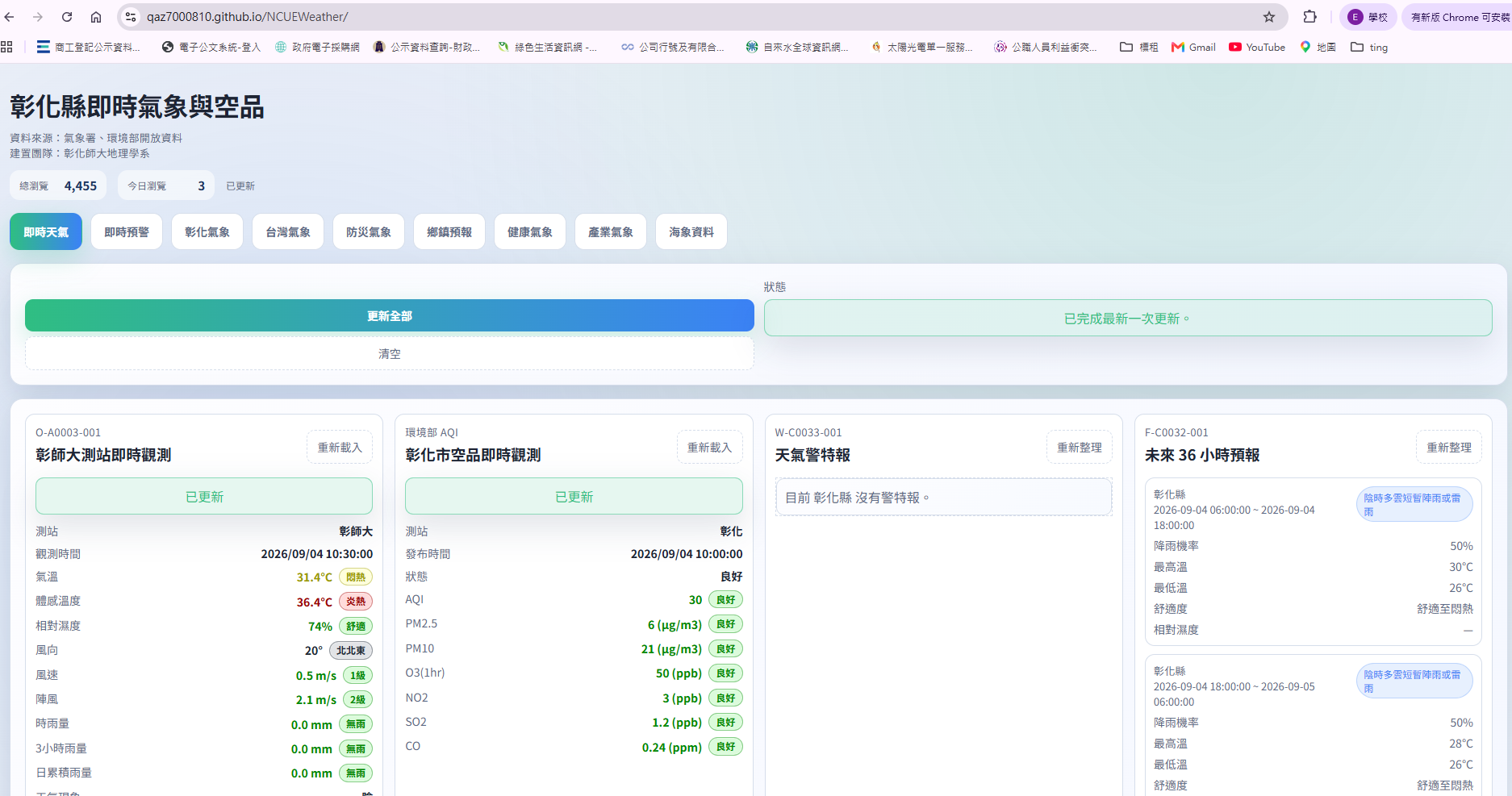
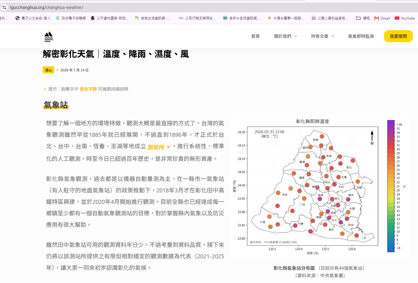
Weather and disaster information in Taiwan is provided by multiple government agencies across separate platforms, with little integration or local focus. Although plentiful, this information is hard for the public, industry workers, and non-specialist disaster response personnel to grasp quickly, which limits its use in practice and in decision-making. Every township in Changhua County has an automatic weather station, and many years of weather and air quality data have accumulated, providing a solid basis for a localized disaster information platform. For these reasons, Sub-project 5 of "Where Mountains Meet the Sea, 'Big Place': Co-creation of Observation and Sustainable Resilience Policy for the Coastal and Foothill Social-Ecological Systems of Changhua County," titled "Establishment and Extended Application of the Changhua Weather and Air Quality Monitoring and Early Warning System," integrated scattered weather and disaster information into a localized database and monitoring platform that provides visualized weather information tailored to the needs of different industries (Figures 24–25). This integrated, value-added system helps the public understand disaster risks, supports decision-making by county government agencies, and improves overall disaster prevention.
Related website: https://qaz7000810.github.io/NCUEWeather/
https://lgucchanghua.org/about-lguc/