SDG 13.3.2
SDG 13.3.2 Climate Action Plan, shared
1. NCUE actively participates in and promotes research and application projects on climate action (Table 1). Through collaboration across government ministries and with industry, these projects combine scientific research, environmental education, industry guidance, and disaster prevention technology to help local communities address climate change and advance sustainable development. They cover climate science research, water resource and agricultural planning, disaster monitoring, invasive species control, and the low-carbon transition of local industries, and provide policy recommendations, scientific data, and technical support. The results strengthen local governments' capacity to respond to climate change and increase residents' environmental awareness and participation, creating a shared action model that integrates research, education, and practice.
| No. | Project name |
|---|---|
| 1 | National Science and Technology Council Project/ Impacts of Large-scale Circulation Changes on Precipitation in the Asian Monsoon Region under Global Warming (III) |
| 2 | Resilient Changbin: Climate Change and the Sustainability of Changhua's Coastal Environment and Industries |
| 3 | Changhua Coastal Meretrix lusoria Habitat Survey and Conservation Education Promotion Program |
| 4 | Taoyuan International Airport Corporation Program / Commissioned Planning and Design for Invasive Red Fire Ant Control Operations |
| 5 | National Science and Technology Council Project / Utilizing Artificial Intelligence and Citizen Scientists for Urban Environmental Vector Survey and Monitoring Project |
| 6 | Animal and Plant Health Inspection Agency, Ministry of Agriculture Project / Comprehensive Control Project for Invasive Red Fire Ants |
| 7 | Kenting National Park Headquarters, National Park Service, Ministry of the Interior / 2025 Kenting National Park Yellow Crazy Ant Control Plan |
2. Project content descriptions are as follows:
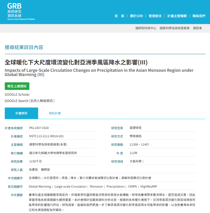
(1) Impacts of Large-scale Circulation Changes on Precipitation in the Asian Monsoon Region under Global Warming (III)
(a) Government Research Bulletin (GRB) (Figure 1):
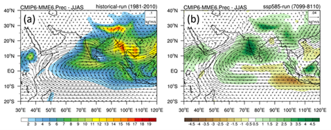
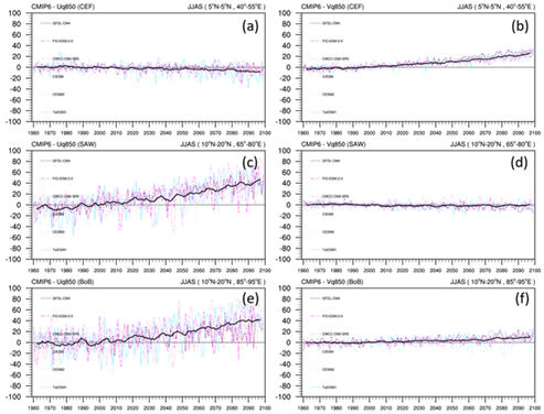
(b) This study primarily investigates the long-term seasonal changes in precipitation and moisture flux across different seasons over the South Asian and East Asian monsoon regions under future warming scenarios. The results indicate that, driven by the continuous rise in global temperatures, atmospheric moisture content increases significantly in both the East Asian and South Asian monsoon domains. In terms of water vapor flux, increased northward transport from the Bay of Bengal during the spring enhances precipitation over the southeastern Tibetan Plateau and the mountainous regions of Northeast India. During the monsoon season, rainfall over the Indian Peninsula increases substantially, facilitated by a robust cross-equatorial flow. This flow transports vast amounts of moisture from the Southern Hemisphere across the equator, traversing the Arabian Sea, the Indian Peninsula, and the Bay of Bengal, before advancing eastward into Indochina and northward to the southern margin of the Tibetan Plateau, where it triggers heavy precipitation. In autumn, the Somali Jet, which typically weakens during this transition, maintains its intensity for moisture transport, and coupled with an anomalous cyclonic circulation, results in increased rainfall across South Asia. Within the East Asian monsoon system during the plum rain and typhoon seasons, precipitation increases over the coastal regions of eastern China and Taiwan. This is attributed to a distinct water vapor flux originating from the Bay of Bengal and moving northward through Indochina and the South China Sea into these regions, accompanied by anomalous vertical ascending motion that further enhances regional rainfall (as shown in Figures 2-3).
(2) Resilient Changbin: Climate Change and the Sustainability of Changhua's Coastal Environment and Industries:
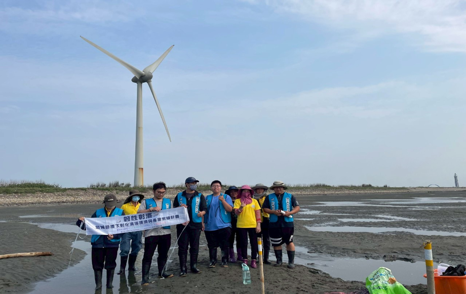
(a)Through the Resilient Changbin project, NCUE uses Changhua's coastal area as a field site for local education on climate change risks, environmental impacts, mitigation, and adaptation. The project draws on expertise in biology, ecology, aquaculture, geography, environmental education, and information technology. It offers 18 interdisciplinary courses and runs 24-, 33-, and 100-hour environmental educator certification courses on climate change as well as carbon inventory courses, integrating climate topics into teaching and local practice. The project also formed a Water Quality Testing Team to help aquaculture farmers monitor changes in water quality and trained 91 intertidal citizen scientists to monitor intertidal zones and wetlands (Figure 4). The project promotes crushed oyster shell substrate improvement and carbon sequestration to enhance wetland biodiversity and carbon monitoring and sequestration. It also held 4 marine camps and educational activities on blue carbon, marine conservation, wetlands, water quality, net-zero emissions, and carbon footprints. These efforts turn climate change, ecological conservation, and local industry issues into environmental education that communities can take part in, strengthening local climate adaptation and environmental resilience.
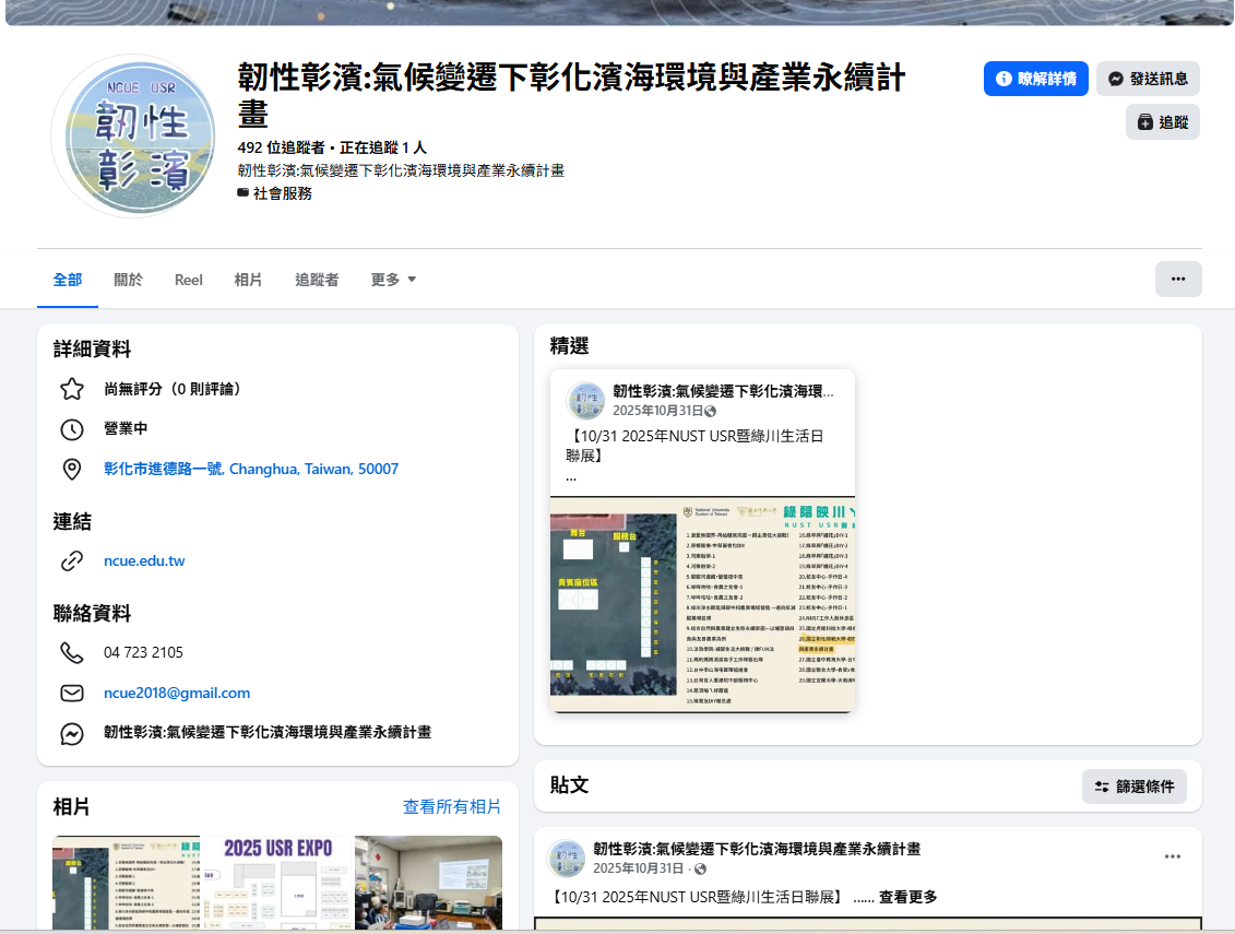
(b) Facebook page of the Resilient Changbin project is shown in Figure 5. (https://www.facebook.com/NCUEUSR/)[cite: 62, 95]
(3) Changhua Coastal Meretrix lusoria Habitat Survey and Conservation Education Promotion Program
(a) Under the Ministry of Education's fourth-phase University Social Responsibility (USR) Project "Resilient Changbin: Climate Change and the Sustainability of Changhua's Coastal Environment and Industries," NCUE combined the 2025 Changhua Coastal Meretrix lusoria Habitat Survey and Conservation and Restoration Promotion Program to deliver local climate change education through university courses, intertidal surveys, aquaculture environment management, marine education, and citizen science activities. The education focuses on coastal risks such as extreme heat, heavy rainfall, drought, salinity changes, and deteriorating aquaculture water quality, and helps students and communities understand their impacts on aquaculture, biodiversity, blue carbon, and the resilience of local industries.
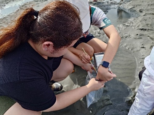
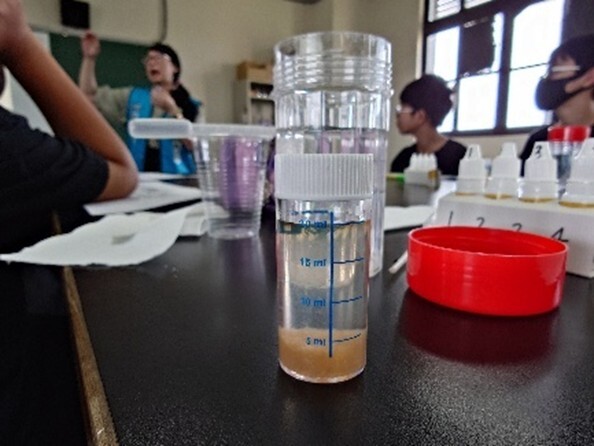
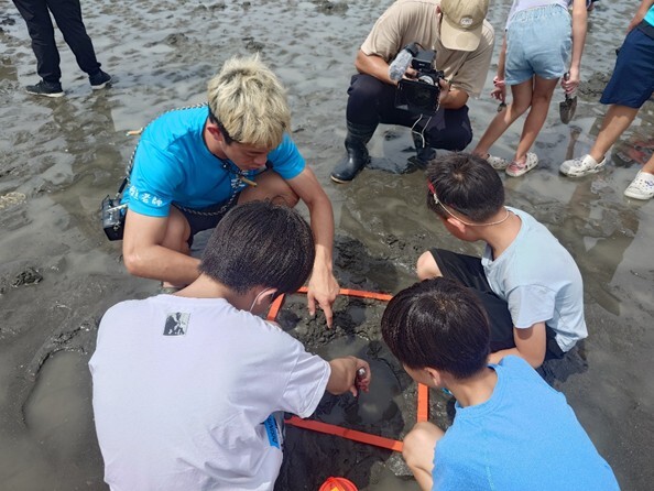
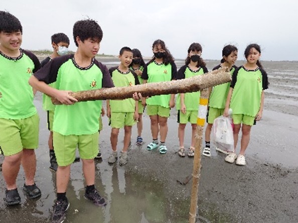
(b) For field practice, NCUE worked with the Changhua County Marine Food Research and Production Cooperative Limited and local groups. In 2025, the project held 4 hard clam habitat surveys and survey volunteer training sessions (50 participant visits), 5 Junior Marine Citizen Scientist activities (146 participant visits), and 3 outdoor ecological survey and field practice sessions (73 participant visits) (Figures 6–9). Activities included water quality and dissolved oxygen testing, sediment grain size analysis, identification of hard clams and other bivalves, benthic surveys, intertidal biodiversity observation, and trials of crushed oyster shell substrate improvement. The survey results are used to track habitat health and to understand how extreme weather and changing environmental conditions affect aquaculture and intertidal ecosystems, and they inform courses, volunteer training, and community conservation actions.
(c) Through collaboration among the university, junior high schools, elementary schools, communities, and the aquaculture industry, and a "big hands leading small hands" marine education model, students not only learned climate change concepts but also participated in on-site observation, data recording, environmental interpretation, and action plan discussions, forming a continuous learning model from climate risk awareness, mitigation, and adaptation education to local monitoring and early warning.
(4) Invasive Ant Control: NCUE conducts ecological monitoring and develops and applies control technologies for red imported fire ants and yellow crazy ants, helping airports, national parks, and agricultural areas reduce damage from invasive species.
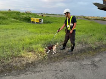
(a) Taoyuan International Airport Corporation Program / Commissioned Planning and Design for Invasive Red Fire Ant Control Operations (Figure 10).
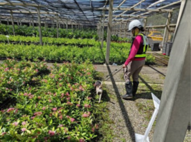
Over the three years of this project, two teams of fire ant detection dogs were deployed to conduct detection operations on airport runways, taxiways, and surrounding telecommunications and navigation aid facilities.
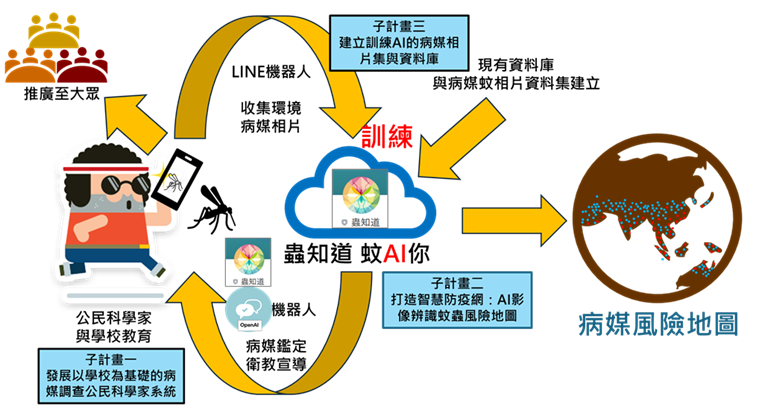
(b) National Science and Technology Council Project / Utilizing Artificial Intelligence and Citizen Scientists for Urban Environmental Vector Survey and Monitoring Project (Figure 11).
Under this project, teachers, students, and citizen scientists at all school levels provided photos of disease vector mosquitoes from various locations. AI training photo datasets have been completed for two of Taiwan's seven major disease vector mosquito species (Aedes aegypti and Aedes albopictus). These photos were tested through the "Insect Knows" LINE bot platform to enhance the accuracy of AI identification training, while the platform simultaneously provides users with feedback on correct disease vector mosquito identification and health education promotion.
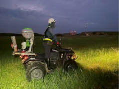
(c) Animal and Plant Health Inspection Agency, Ministry of Agriculture Project / Comprehensive Control Project for Invasive Red Fire Ants (Figures 12-13).
(d) Kenting National Park Project / 2025 Kenting National Park Yellow Crazy Ant Control Plan.
The 2025 project expanded the bait treatment area, the amount of bait used, and the number of artificial bait stations in the Shadao and Gangkou plots. It also applied liquid baits and insect growth regulators to assess the effectiveness of bait treatments and to evaluate long-term control strategies and recommendations for yellow crazy ant populations in Kenting National Park (Figure 14).