
SDG 13.3.3
SDG 13.3.3 Co-operative planning for climate change disasters
NCUE actively collaborates with government agencies and research institutions on climate change and disaster adaptation projects (Table 1), working from basic research and technology applications to local participatory action to strengthen Taiwan's capacity to respond to extreme weather and disasters. Five representative collaborative cases are presented below, covering large-scale climate dynamics, coastal environmental change, and disaster observation.
| No. | Project Name |
|---|---|
| 1 | Impacts of Large-scale Circulation Changes on Precipitation in the Asian Monsoon Region under Global Warming (III) |
| 2 | Monitoring Geomorphic Change and Environmental Controls of the Tidal Flat in the Changhua Coast Using Multi-scale Remote Sensing (Sub-project 1) (III) |
| 3 | Agency of Rural Development and Soil and Water Conservation, Ministry of Agriculture / 2025 Spatial Information Collection, Interpretation, and Change Analysis of Sediment-Related Disasters |
| 4 | Where Mountains Meet the Sea, "Big Place": Co-creation of Observation and Sustainable Resilience Policy for the Coastal and Foothill Social-Ecological Systems of Changhua County (I) |
| 5 | Collaboration with the Central Weather Administration on Earthquake Observation and Weather Monitoring |
1. Impacts of Large-scale Circulation Changes on Precipitation in the Asian Monsoon Region under Global Warming (III)
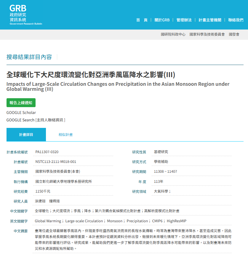
(1) Government Research Bulletin (GRB) (Figure 1):
https://www.grb.gov.tw/search/planDetail?id=16551737[cite: 62, 95]
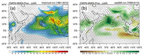
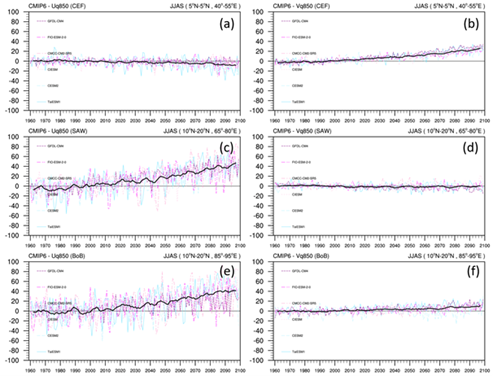
(2) Project Highlights: This study primarily investigates the long-term seasonal changes in precipitation and moisture flux across different seasons over the South Asian and East Asian monsoon regions under future warming scenarios. The results indicate that, driven by the continuous rise in global temperatures, atmospheric moisture content increases significantly in both the East Asian and South Asian monsoon domains. In terms of water vapor flux, increased northward transport from the Bay of Bengal during the spring enhances precipitation over the southeastern Tibetan Plateau and the mountainous regions of Northeast India. During the monsoon season, rainfall over the Indian Peninsula increases substantially, facilitated by a robust cross-equatorial flow. This flow transports vast amounts of moisture from the Southern Hemisphere across the equator, traversing the Arabian Sea, the Indian Peninsula, and the Bay of Bengal, before advancing eastward into Indochina and northward to the southern margin of the Tibetan Plateau, where it triggers heavy precipitation. In autumn, the Somali Jet, which typically weakens during this transition, maintains its intensity for moisture transport, and coupled with an anomalous cyclonic circulation, results in increased rainfall across South Asia. Within the East Asian monsoon system during the plum rain and typhoon seasons, precipitation increases over the coastal regions of eastern China and Taiwan. This is attributed to a distinct water vapor flux originating from the Bay of Bengal and moving northward through Indochina and the South China Sea into these regions, accompanied by anomalous vertical ascending motion that further enhances regional rainfall (as shown in Figures 2-3).
2. Monitoring Geomorphic Change and Environmental Controls of the Tidal Flat in the Changhua Coast Using Multi-scale Remote Sensing (Sub-project 1) (III)
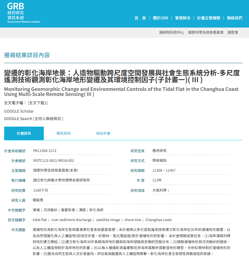
(1) Government Research Bulletin (GRB) (Figure 4):
https://www.grb.gov.tw/search/planDetail?id=16727418[cite: 62, 95]
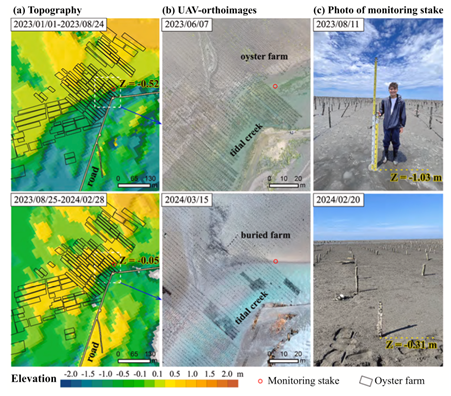
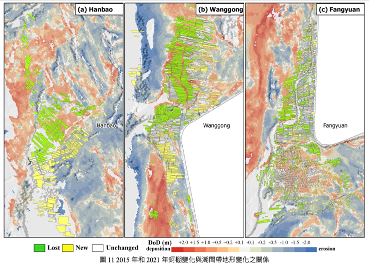
(2) Project Highlights: The project used multi-scale remote sensing to monitor topographic change on the tidal flats of the Changhua coast. It collected 299 Landsat and Sentinel-2 images from 2015–2024 and, combined with tide level data from Taichung Port, developed the LogiTide2DEM logistic regression model to reconstruct annual intertidal topography (published in an SCI journal). Oyster rack distribution was mapped through drone photogrammetry and aerial photo interpretation. From 2015 to 2021, oyster racks decreased from 2,814 (198.87 hectares) to 1,714 (130.54 hectares), mainly because of landward sandbar migration and tidal channel shifts. Oyster racks are best placed on tidal flats at elevations of −0.6 to +0.4 m that are submerged for about half of each day; in 2023, the eastward migration of a sandbar reduced the area suitable for oyster farming by about one-third (Figures 5–6).
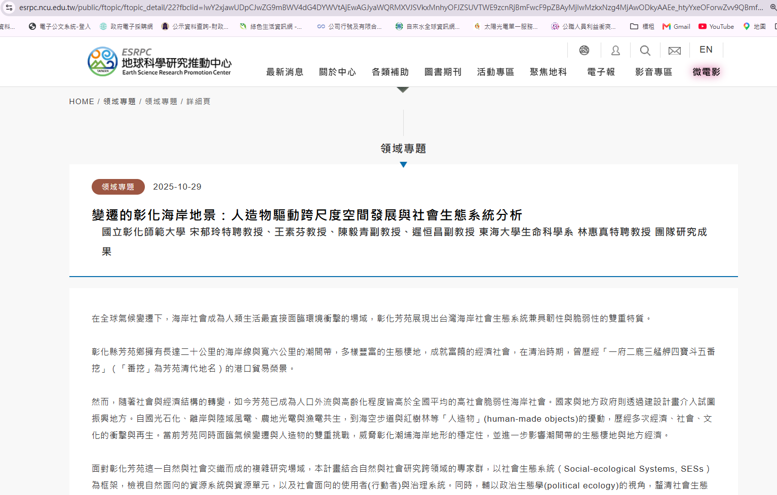
The long-term coastal topographic monitoring methods and data developed by the project can help water resources and fisheries authorities and local governments monitor coastal change risks, adjust aquaculture areas, and plan climate adaptation. Combined with local interviews conducted by Sub-project 6, the project links geomorphological science with the adaptation experience of coastal communities. Related webpage is shown in Figure 7.
3. 2025 Spatial Information Collection, Interpretation, and Change Analysis of Sediment-Related Disasters
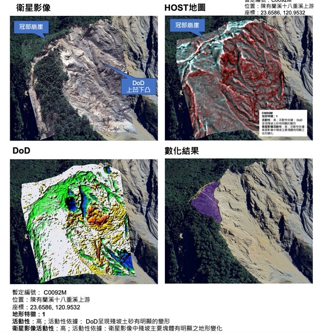
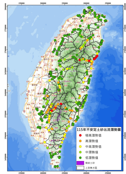
Commissioned by the Agency of Rural Development and Soil and Water Conservation, Ministry of Agriculture, this project uses multi-scale remote sensing for emergency interpretation, topographic change monitoring, and risk assessment of sediment-related disasters across Taiwan, directly supporting government disaster prevention and reconstruction. In 2025, the project covered nine disaster events: the January 21 and January 30 earthquakes; the June 13, July 21, July 28, and October 20 heavy rainfall events; and Typhoons Danas, Wipha, Podul, and Ragasa. The team compared pre- and post-disaster multi-temporal satellite images from Sentinel-2, PlanetScope, Pleiades, and SkySat and interpreted 1,260 disaster sites during the emergency phase, providing a basis for rapid assessment of disaster extent and recovery planning. Using SPOT imagery, the team also built the 2024 nationwide landslide map layer with 37,669 landslide records, calculated landslide area and landslide ratio by watershed, and delineated landslide severity zones as a scientific basis for sediment disaster risk assessment and priority management of high-risk areas. In addition, unmanned aerial vehicles captured high-resolution images of 14 areas covering 36.26 square kilometers to produce orthophotos and digital surface models. The team delineated residual slopes, estimated unstable sediment volumes and risk levels, quantified in-channel sediment deposition, and identified high-risk river reaches. The resulting potential map of unstable sediment in watersheds supports the competent authority and its branches in disaster prevention planning, river dredging, and watershed management, strengthening early warning and response to extreme rainfall and typhoons (Figures 8–9).
4. Where Mountains Meet the Sea, "Big Place": Co-creation of Observation and Sustainable Resilience Policy for the Coastal and Foothill Social-Ecological Systems of Changhua County (I)
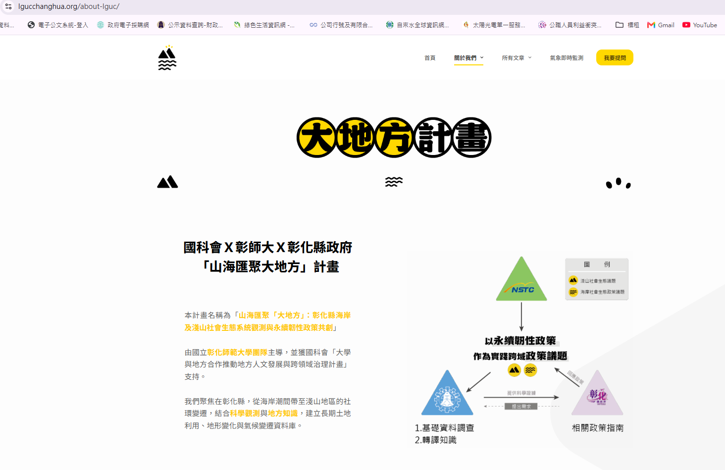
(1) This integrated project divides Changhua into foothill and coastal zones based on their social-ecological systems and addresses five topics: "Land Use Change," "Coastal Topographic Change," "Local Communication in Coastal Communities," "Foothill Pest Control," and "Long-term Meteorological Data Monitoring," studied by Sub-projects 1 to 5. These topics correspond to the Changhua County Government's policy priorities for coastal and foothill areas: coastal areas where the green energy transition has affected residents' lives and livelihoods, and foothill areas where pests, air pollution, and extreme weather affect daily life and livelihoods. Improving agricultural and fishery production, living environments, and public health in these areas is a key governance goal of the Changhua County Government (Figure 10).
(2) National Science and Technology Council × NCUE × Changhua County Government "Where Mountains Meet the Sea, Big Place" Project Website (Figure 11): https://lgucchanghua.org/[cite: 62, 95]

5. Collaboration with the Central Weather Administration on Earthquake Observation and Weather Monitoring: Enhancing National Disaster Early Warning and Long-Term Climate Data
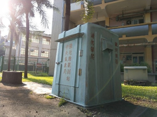
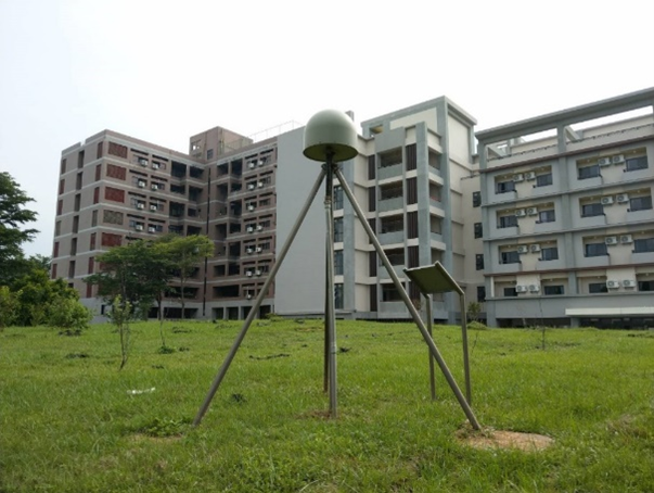
(1) Taiwan is located at the boundary of the ‘Eurasian Plate’ and the ‘Philippine Sea Plate’; therefore, earthquakes are frequent occurrences in Taiwan. According to data from the Seismological Center of the Central Weather Administration from 1991 to 2015, about 3,000 earthquakes occurred in Taiwan every month on average, and 102 major earthquake-related disasters occurred from 1901 to 2016. Although accurate earthquake prediction has yet to be fully developed, the increasing availability of seismic observation data helps improve disaster relief efficiency and reduce loss of life and property. In cooperation with the Central Weather Administration, NCUE has installed strong-motion and other observation instruments on both campuses and in the faculty housing area, and has set up the Baisha Weather Station.
(2) The seismic observation instruments are described below (Figures 12–14).
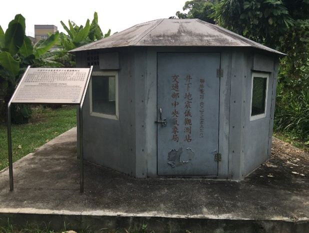
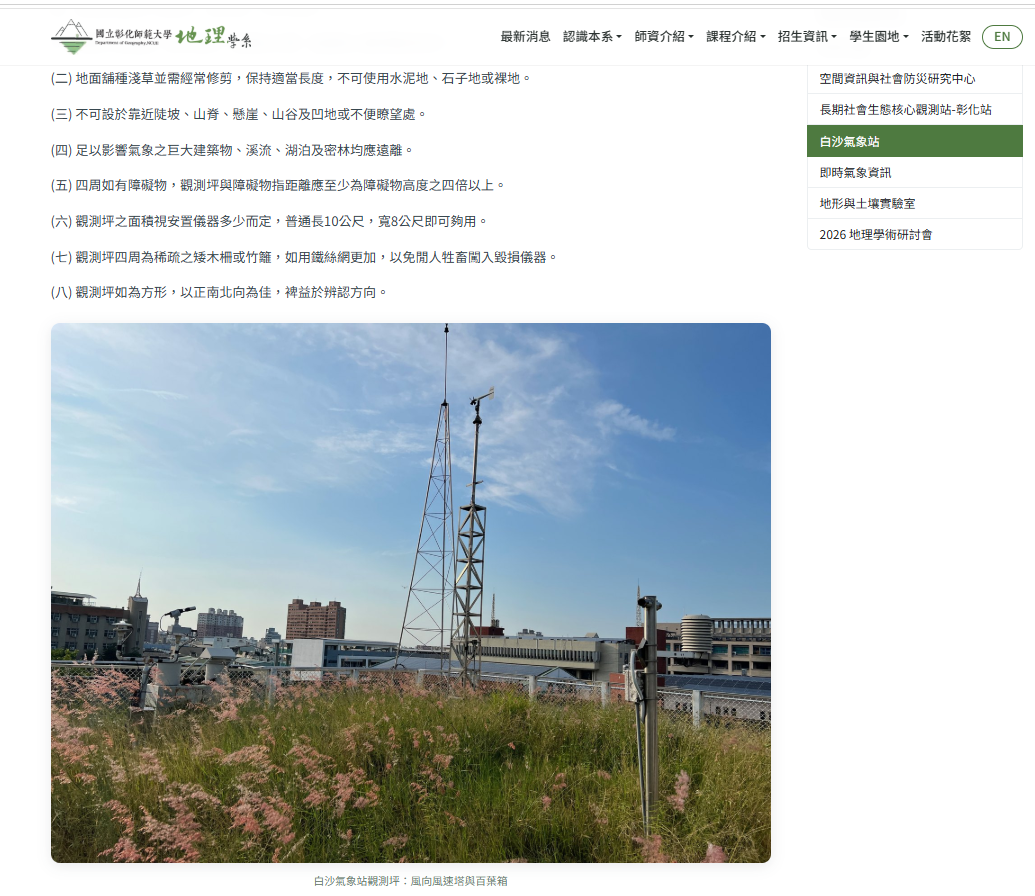
(3) To build partnerships with academia, the Central Weather Administration (CWA) cooperates with several universities in Taiwan through industry–academia cooperation, providing students with practical training sites. The automatic weather station operated by NCUE's Department of Geography is one of these sites and the only partner station at a university in central Taiwan. The station, located on the rooftop of the Department of Geography building, began operation in November 1997 and entered its 28th year in 2025 (Figure 15). Its meteorological instruments and peripheral equipment make real-time observations, and the data are transmitted to the CWA's Southern Region Weather Center for compilation and use by disaster prevention agencies. The station environment is shown in the photo. With its long observation record, the station also helps the public and researchers understand the climate characteristics and changes of the region.
NCUE Baisha Weather Station Webpage (Figure 16):
https://geo.ncue.edu.tw/p/weather-station/[cite: 62, 95]

Through interdisciplinary research and collaboration with governments at multiple levels, NCUE's work spans scientific understanding of climate-related disasters, local action, and policy impact. This work strengthens society's capacity to respond and adapt to climate change and disaster risks and contributes to SDG 13 (Climate Action).