SDG 14.3.4
SDG 14.3.4 Technologies towards aquatic ecosystem damage prevention (direct work)
NCUE implements research projects and related activities, including the Department of Geography’s project “The Interactive Relationship between Coastal Energy Landscapes and Local Structural Changes in Changhua: A Satellite Image Inversion Analysis of the Impacts of Natural Processes and Human Development on Intertidal Wetland and Sediment Grain Size (Overall Project and Subproject 1)” and Department of Biology’s project “Changhua Coastal Meretrix lusoria Habitat Survey, Conservation, and Restoration Outreach Program.” A brief introduction to the project is provided below.
1. The Interactive Relationship between Coastal Energy Landscapes and Local Structural Changes in Changhua: A Satellite Image Inversion Analysis of the Impacts of Natural Processes and Human Development on Intertidal Wetland and Sediment Grain Size (Overall Project and Subproject 1)
The Changhua coast has the largest area of intertidal wetlands in Taiwan, serving as an important ecological habitat along the western coast as well as a major site for oyster farming and clam harvesting. It is also home to Fangyuan’s sea-buffalo oyster-harvesting culture. The Department of Geography in NCUE implemented this project to conduct long-term monitoring and analysis of the impacts of natural processes and human development on intertidal geomorphology and sedimentary environments. The natural processes include typhoons and the northeast monsoon, while human development include offshore wind power, floating solar installations, and wetland walkway.
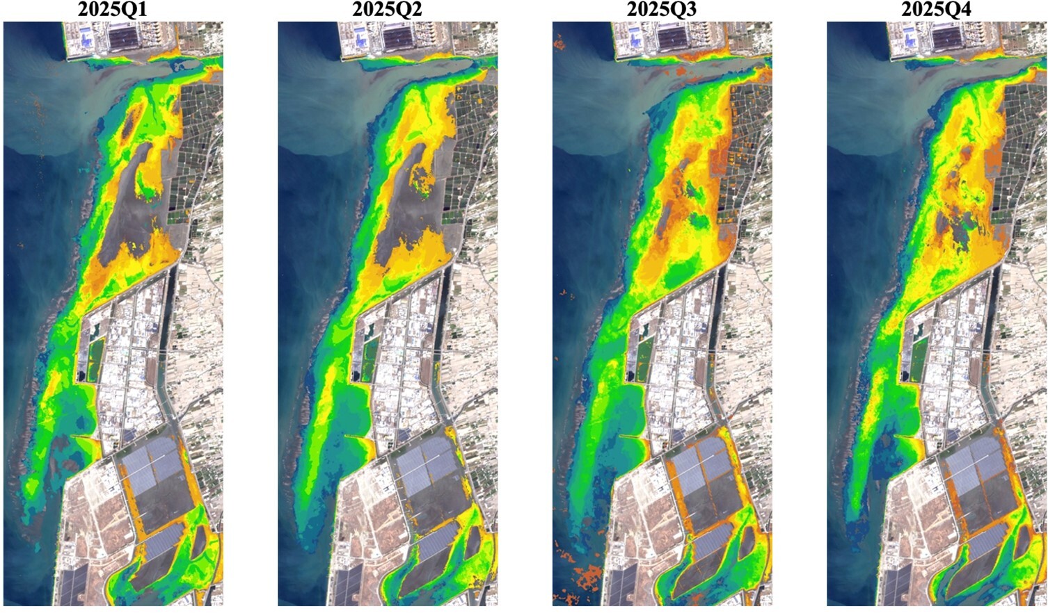
In the first year, the project integrated multi-temporal satellite imagery from Sentinel-1, Sentinel-2, SPOT, and Landsat with U-Net deep-learning classification to develop the LogiTide2DEM intertidal topographic inversion method. This approach helps to establish seasonal-scale digital elevation models (DEMs) of Changhua intertidal wetlands for the period from 2017 to 2025 and to analyze the relationships between surface sediment grain size and satellite-derived spectral indices.
The results indicate significant seasonal differences in sediment deposition and erosion across the Changhua intertidal wetlands. During winter, deposition generally occurs under the influence of the northeast monsoon and alongshore sediment transport, whereas in summer, typhoons and strong waves cause erosion and sediment redistribution. During Typhoon Gaemi in 2024, localized sediment deposition in Fangyuan intertidal wetlands reached 0.4 ± 0.2 m, which was consistent with local recorded height of oyster farm burial.
The project also integrates its findings with erosion-pin monitoring and sediment grain-size surveys conducted by the Long-Term Socio-Ecological Research (LTSER) Core Research Station—Changhua. This integration helps address the limitations of point-based observations in capturing large-scale spatial changes. The seasonal-scale habitat and environmental data generated by the project can support ecological surveys of intertidal crabs, assessments of the impacts on the oyster-farming industry, and the development of sustainable coastal management strategies. The results also provide a scientific basis for assessing the impacts of energy development on intertidal ecosystems. The information is shown in Figure 1.
2. Department of Biology
2025 Local Marine Stewardship and Conservation Project: Changhua Coastal Meretrix Lusoria Habitat Survey, Conservation, and Restoration Project.
Under the Ministry of Education Fourth-Phase USR Project, "Resilient Changbin: Climate Change and the Sustainability of Changhua's Coastal Environment and Industries," NCUE Center for General Education worked with Caohu Junior High School, Hanbao Elementary School, Fangyuan Elementary School, and Houliao Elementary School to promote marine education, intertidal observation, clam identification, water-quality monitoring, blue carbon, environmentally friendly aquaculture, and argi-food as well as fisheries-food education. Being dedicated to marine education, Caohu Junior High School integrates marine issues into alternative curriculums, special education, and aesthetic creation. The school not only received the Ministry of Education’s Marine Education Contribution Award in 2021 and 2025, but also won the Excellence Award in the junior-high category of the Marine Education Innovative Teaching Quality Team Selection.
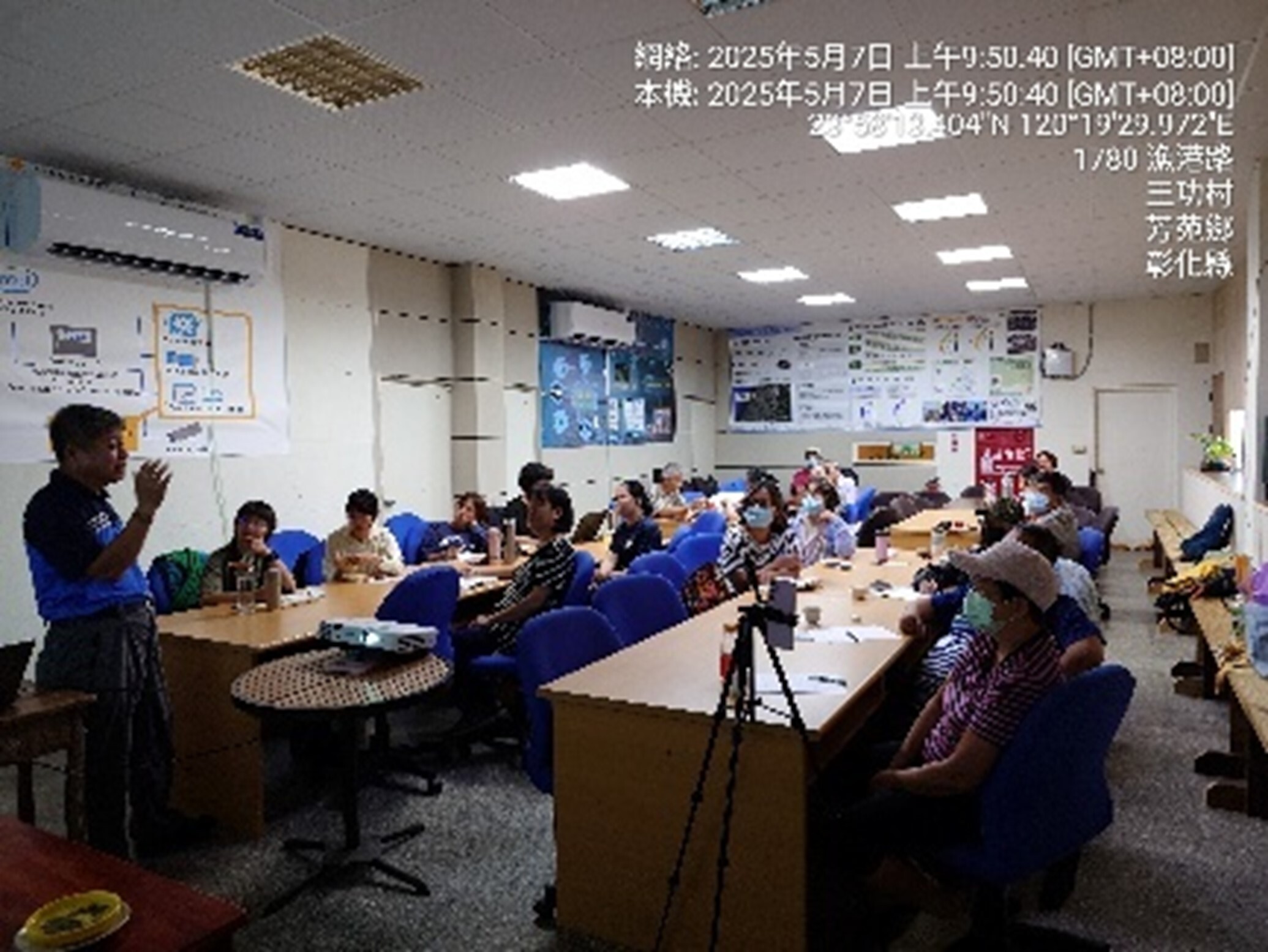
In collaboration with the Changhua Marine Food Research Production Cooperative and local communities, NCUE conducted clam-habitat surveys, sediment improvement, and Marine Citizen Scientists training at Xinbao Wetland. In 2025, we had completed four clam-habitat surveys and conducted an investigative volunteer training accumulated a total of 50 participant-times; on top of that, we had also held five Junior Marine Citizen Scientist activities reached 146 participants and three outdoor ecological survey and field-operation activities reached 73 participants. The activities included water-quality and dissolved-oxygen testing, sediment analysis, bivalve identification, benthic-fauna surveys, intertidal biodiversity observation, and an oyster-shell sediment-improvement trial. Through a “Hands Together” way, Caohu Junior High School students led Hanbao Elementary School pupils in intertidal surveys, building a cooperation model that brings together the University, junior high schools, elementary schools, and communities, which helps to preserve the wetland with local industries. Photographs of the program activities are shown in Figures 1–2 below.