SDG 13.3.4 Inform and support government
1. Our faculty members implemented Ministry of Science and Technology projects to provide advice and assistance to local and regional governments on the future planning of agricultural production systems, disaster prevention, and water resource allocation, as shown in Table 1.
Table 1. Serial No., Principal Investigator, Project Title
|
No. |
Project leader |
Project name |
|
1 |
Professor Lin Chung-Chi |
Impacts of Climate Change on Lowland Ecology and Lowland Ant Problems Due to Community Changes: Discussion and Solutions (Annex 13.3.2A - Report of Outcomes) |
|
2 |
Professor Tu Jien-Yi |
Spatial distribution of rainfall hotspots influenced by different weather systems in Taiwan (Annex 13.3.2B - Report of Outcomes) |
Details of the project are provided below:
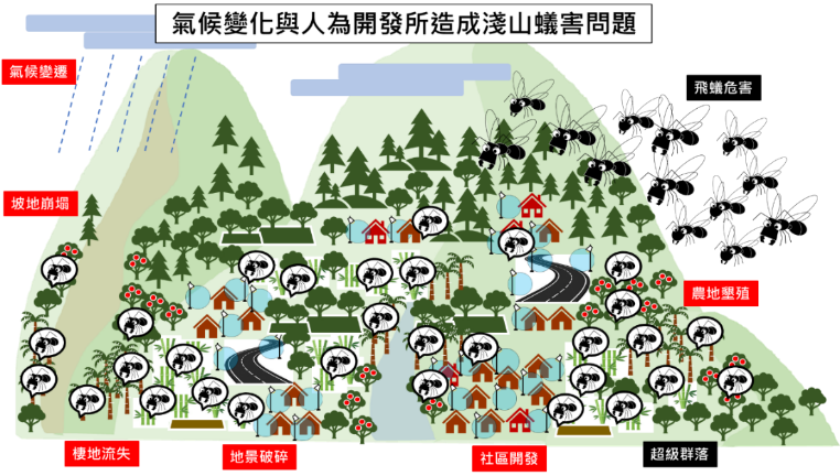
(1)The Ministry of Science and Technology’s project was led by NCUE Professor Lin Chung-Chi. The project title is: “Impacts of Climate Change on Lowland Ecology and Lowland Ant Problems Due to Community Changes: Discussion and Solutions”. Issues targeted by the project: given natural disasters due to climate change and development stress, lowland areas in Taiwan are ecologically fragile, with issues of landscape fragmentation, ecological barriers, and habitat loss. In recent years, the emerging problem of ant infestation has appeared in the lowland towns of central and southern Taiwan. Ants flood into houses like streams and flying ants invade houses like black fog. Such abnormal ecological phenomena are a warning of the gradual loss of health in Taiwan’s ecological system. The project covered multiple areas, delving into the causes behind the ant infestation affecting lowland residents and identifying the issues of landscape fragmentation, ecological loss, and development stress. Within the framework of slope ecosystem services, the research team investigated key biologic facies in the habitats, analysed landscape changes, established relevant indicators, and analysed environmental vulnerability and ecological potential. Given the mechanism of the impact of ant problems on village industries and tourism, a lowland agricultural production system with ecosystem service potential and human welfare benefits was proposed under the context of climate change (Figure 1).
|
|
|
Figure 1. Ant infestation in shallow mountains is attributed to climate change and human factors |
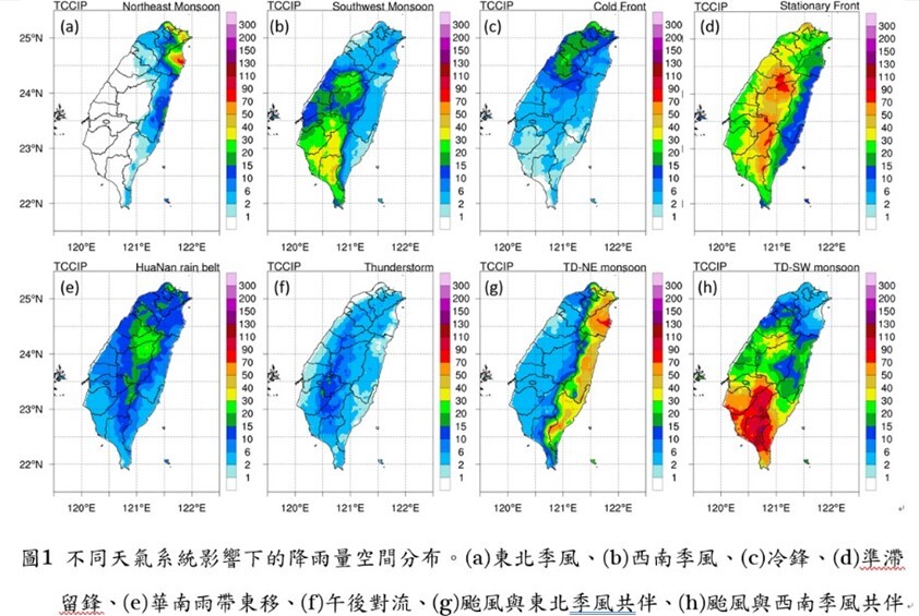
(3)Prof. Jien-Yi Tu/National Science and Technology Council (NSTC) Project/Spatial distribution of rainfall hotspots in Taiwan under the influence of different weather systems. Project description: This research analyzes the impacts of different weather patterns on rainfall in Taiwan and finds that there is a significant interaction between large-scale circulation, weather systems, and topography. Different circulation patterns and moisture transport, in conjunction with topographical effects, result in variations in the distribution of rainfall hotspots. Moreover, the sources of moisture also vary widely. Some weather systems are primarily associated with near-surface moisture transport (e.g., afternoon convection), while others are more dominant below 850 hPa (e.g., the northeast monsoon), some concentrate in the 850-700 hPa layer (e.g., stationary fronts), or even higher in the 700-500 hPa layer (e.g., the eastward movement of the South China Rainband). These differences in characteristics also remind us that future analyses of different weather systems should pay special attention to the location of the main moisture transport layer. The research findings allow us to gain a deeper understanding of the relationship between rainfall hotspots and circulation, providing substantial assistance and contributions to future government disaster preparedness planning. (Figure 2)
|
|
|
Figure 2. Spatial distribution of rainfall under the influence of different weather systems |
2. Taiwan is located at the boundary of the “Eurasian Plate” and the “Philippine Sea Plate”, so earthquakes are very frequent. According to the seismic data of the Seismic Information Centre, Central Weather Bureau, from 1991 to 2015, about 3,000 earthquakes occurred in Taiwan every month on average, and 102 major earthquake disasters occurred from 1901 to 2016. Although an accurate earthquake prediction technology is not available yet, increasing seismic observation data are rather helpful in improving the efficiency of disaster relief and reducing the loss of life and property during earthquakes. In cooperation with the Central Weather Bureau, NCUE has installed strong motion observation apparatuses in the two campuses and in family quarters as well as the Bai Sha Weather station.
(1)Below are some more details about the seismic observation apparatuses. (Figures3-5)
|
|
|
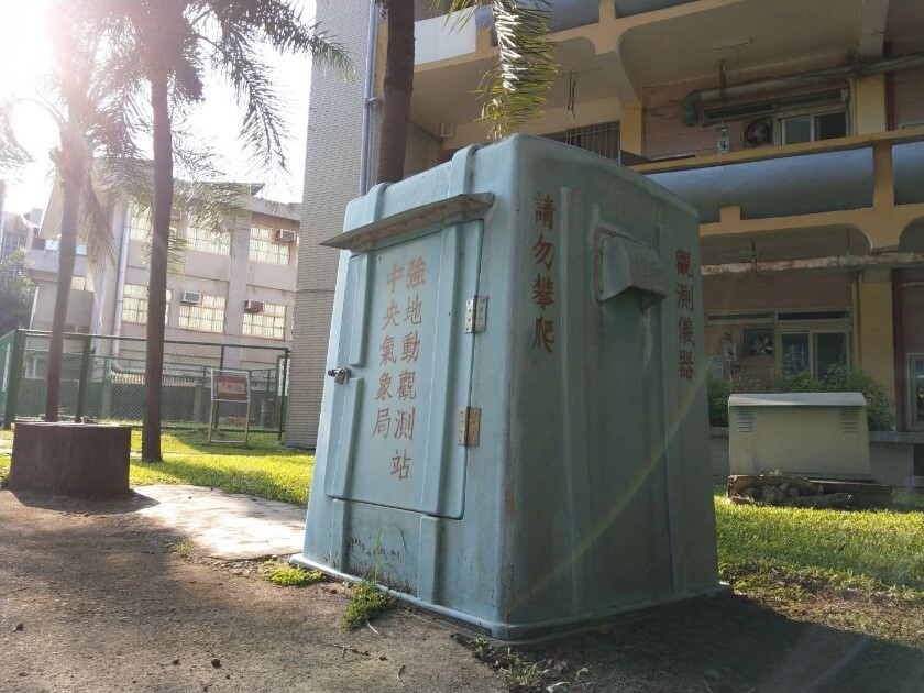
Figure 3. Strong motion observation station in Jinde Campus The observation station houses the strong motion observation apparatus. The time, location, and size of an earthquake can be calculated when many stations are connected to form a seismograph network |
|
|
|
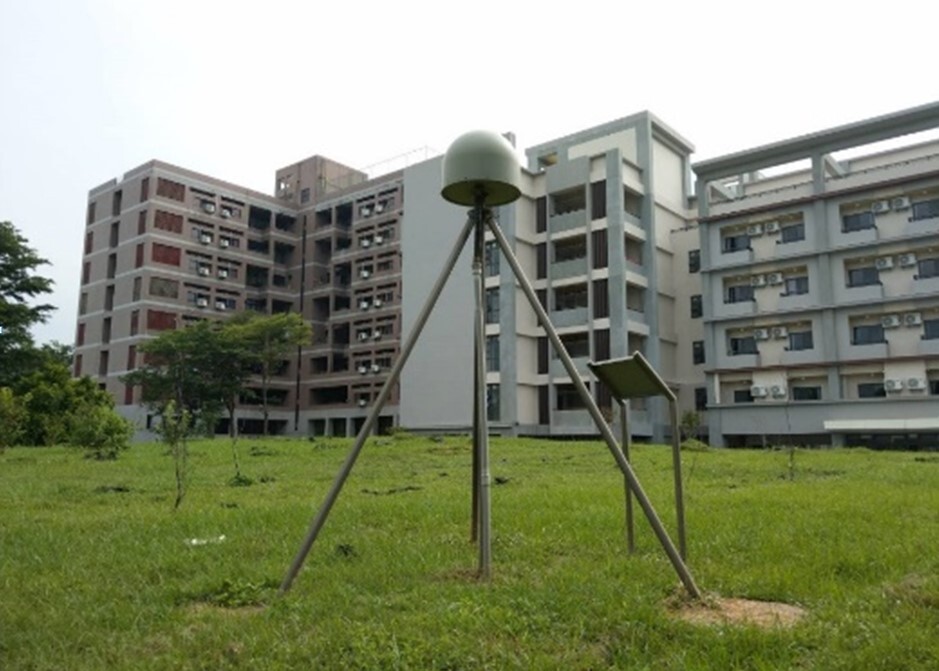
Figure 4. Crustal deformation observation station in Baoshan Campus. The station continuously receives signals emitted from the global satellite positioning system, and with the received signals at the same time by other stations, it can accurately calculate the station’s location relative to other stations. Long-term observation data could reflect significant surface displacement due to major earthquakes. Also, the data on small crustal deformation occurs during earthquakes are very helpful in understanding crustal movement and earthquake potential |
|
|
|
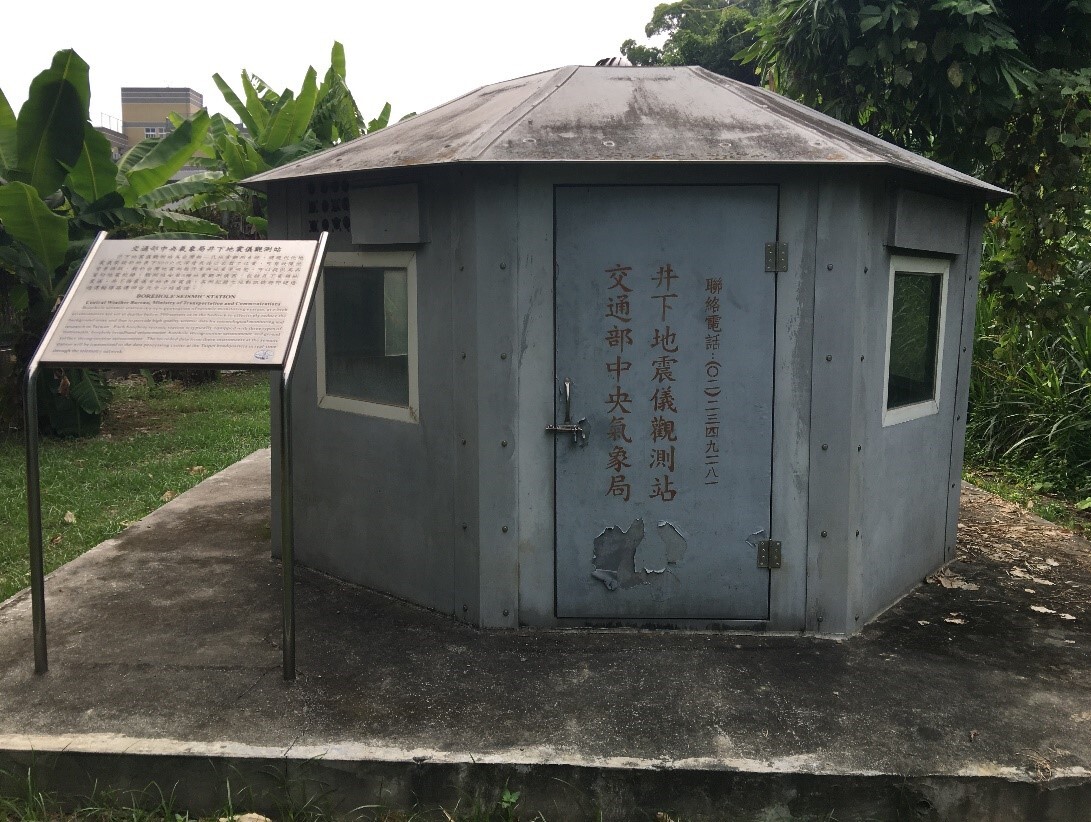
Figure 5. Underground seismograph observation station in family quarters. The seismograph installed at a depth of 300 meters in the well can significantly reduce the interference from surface noise and obtain high quality ground motion signals, improving the accuracy of seismic locating and the ability to monitor regional small-scale earthquakes |
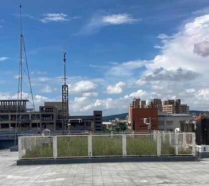
(2)The Central Weather Bureau works with academic institutions in Taiwan by installing weather facilities for teaching purposes. They can be used as practice areas by students. The automatic meteorological observation station run by NCUE’s Department of Geography is one of such facilities. It is also the only station in central Taiwan under the partnership. The automatic meteorological station was built on the attic of the Geography Department Building. It was commissioned in November 1997 and has run for 25 years by 2022 (Figure 6). The meteorological instruments and peripheral devices are used for real-time observation, and meteorological data are synchronised with the South District Weather Centre of the Central Weather Bureau. The real-time data are useful for disaster prevention units. The features of the observation station are shown in the photo below. In addition, sufficiently long observation time also means that the station could help people better understand the regional climate characteristics and changes and researchers conduct relevant studies.
|
|
|
Figure 6. NCUE’s Bai Sha weather station |