SDG 13.3.3 Co-operative planning for climate change disasters
Taiwan is located at the boundary of the “Eurasian Plate” and the “Philippine Sea Plate”; therefore, earthquakes are very frequent. According to seismic data from the Seismic Information Centre (Central Weather Bureau) from 1991 to 2015, about 3,000 earthquakes occured in Taiwan every month on average, and 102 major earthquake disasters occurred from 1901 to 2016.
The director of the Seismic Information Center stated in March 2022 that it is highly likely that the “active seismic period” has begun in the Pacific Ring of Fire, which includes Taiwan.
Although an accurate earthquake prediction technology is not available yet, increasing seismic observation data are rather helpful in improving the efficiency of disaster relief and reducing the loss of life and property during earthquakes. In cooperation with the Central Weather Bureau, NCUE has installed strong motion observation apparatuses on the two campuses and in the Family Quarters as well as the Bai Sha weather station.
1. Below are some more details about the seismic observation apparatuses. (Figures 1-3)
|
|
|
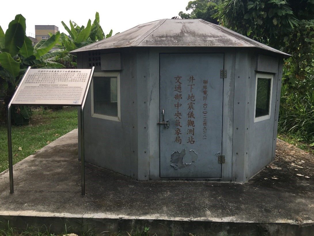
Figure 1. Strong motion observation station in Jinde Campus. The observation station houses the strong motion observation apparatus. The time, location, and size of an earthquake can be calculated when many stations are connected to form a seismograph network |
|
|
|
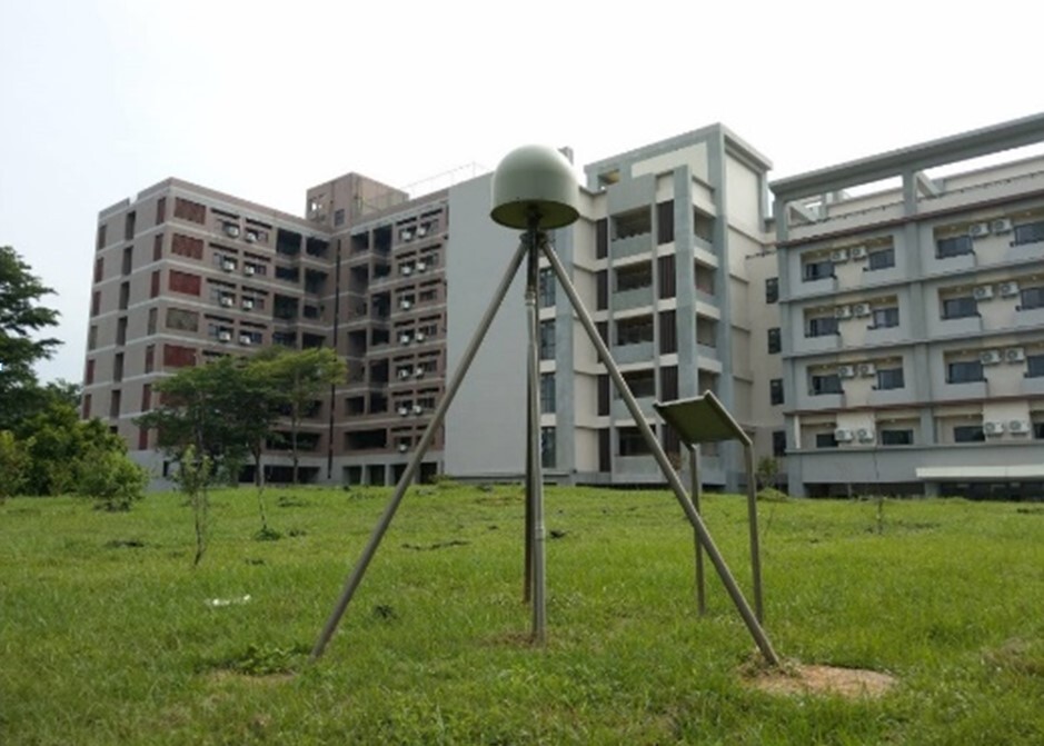
Figure 2. Crustal deformation observation station in Baoshan Campus. The station continuously receives signals emitted from the global satellite positioning system and, with the signals received simultaneously by other stations, it can accurately calculate its location relative to other stations. Long-term observation data can reflect significant surface displacement due to major earthquakes. In addition, data on small crustal deformation during earthquakes are very helpful in understanding crustal movement and earthquake potential |
|
|
|
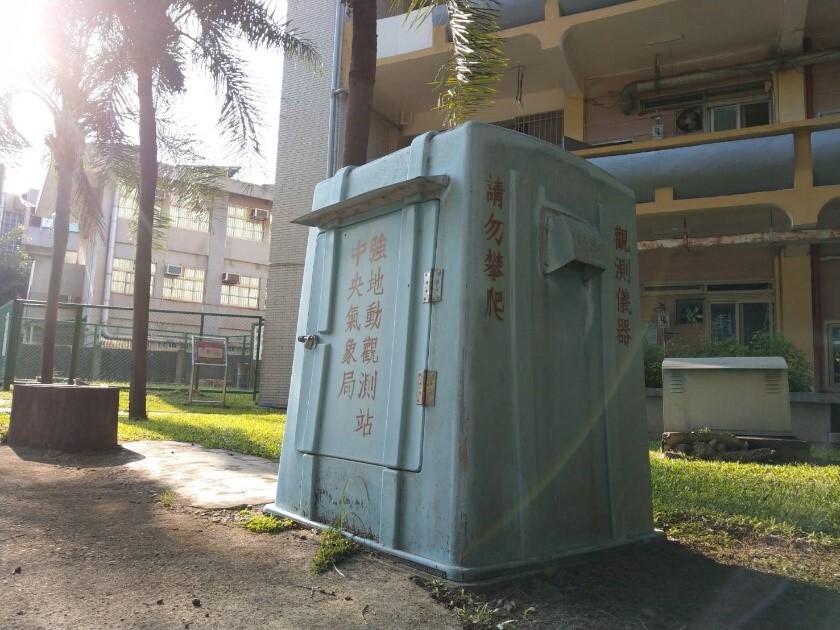
Figure 3. Underground seismograph observation station in the Family Quarters. The seismograph installed at a depth of 300 metres in the well can significantly reduce interference from surface noise and obtain high quality ground motion signals, improving the accuracy of seismic locating and the ability to monitor small-scale, regional earthquakes |
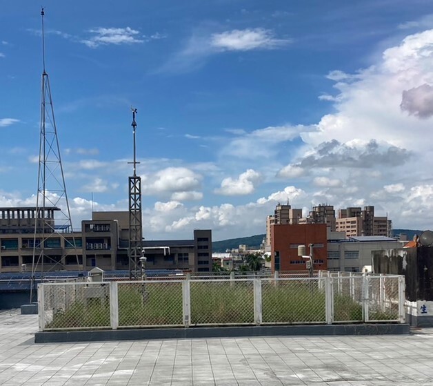
2. The Central Weather Bureau works with academic institutions in Taiwan by installing weather facilities for teaching purposes. They can be used as practice areas by students. The automatic meteorological observation station run by NCUE’s Department of Geography is one such facility. It is also the only such station in central Taiwan under the partnership. This automatic meteorological station was built in the attic of the Geography Department Building. It was commissioned in November 1997 and will have run for 25 years in 2022(Figure 4). The meteorological instruments and peripheral devices are used for real-time observation, and meteorological data are synchronised with the South District Weather Centre of the Central Weather Bureau. Real-time data are useful for disaster prevention units. The features of the observation station are shown in the photo below. In addition, a sufficiently long observation time also means that the station could help researchers better understand regional climate characteristics and changes and allow them to conduct relevant studies.
|
|
|
Figure 4. NCUE’s Bai Sha weather station |