SDG 15.3.1 Sustainable use, conservation and restoration of land (policy)
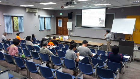
NCUE has at least 6 ongoing projects and activities, including: Environmental Education Centre’s “Project of Taoyuan International Airport Corporation/Entrusted Planning and Design for Red Imported Fire Ants (RIFA) Control”, “24-, 33-Hour Courses for Environmental Educator Certification”, Biology Department’s “Project of the Division of Science and Technology/Discussion and Solution Strategies on the Ant Infestation Problems in the Qianshan Caused by the Impact of Climate Change on the Ecology of Qianshan and the Changes in the Community”, “Management Office of Hualien Forest Zone, Forestry Bureau, Council of Agriculture/Entrusted Professional Service Case for Ant Investigation Project in Masadi Forest Park”, a project of the Division of Science and Technology, “Development Microbial Control technology of Agricultural Pest Ant”, a project of the Bureau of Animal and Plant Health Inspection and Quarantine, “Council of Agriculture/Development of Core Technologies and Establishment of Safety Assessment Model of the Agricultural Spraying Drone Industry Chain–Field Trials for Using Agricultural Drones to Control RIFA through the Management of Drone Pesticide Spraying Delegation System”, a project of Kenting National Park, “Yellow Crazy Ant Invasion Status Investigation and Control Strategy Research in Kenting National Park”, and Disaster Prevention and Information Center’s “Using Lidar Point Cloud in the Forest and Hyperspectral Data to Analyze the Spectral Characteristics of Terrain and Build a Canopy Elevation Model”, and related activities organized by the Science Education Center,as listed in Table 1. They will be briefly described in the following.
Table 1. Related activities and projects
|
Project activities |
Subsidized units |
|
Project of Taoyuan International Airport Corporation/Entrusted Planning and Design for Red Imported Fire Ants (RIFA) Control |
Taoyuan International Airport Corporation |
|
Environmental Educator 24-hour and 33-hour Certification Class |
|
|
Discussion and Solutions to the Problem of Pest Ant Damage Caused by the Impact of Climate Change on the Lowland Ecology and the Change of the Lowland Community |
Ministry of Science and Technology |
|
Masadi Forest Park Ant Survey Project Commissioned Contract for Professional Services |
Hualien Branch, Forestry and Nature Conservation Agency, Ministry of Agriculture |
|
Program for Kenting National Park/Investigation on Invasion and Control Strategy of Yellow Crazy Ants in Kenting National Park |
Kenting National Park |
|
Using LiDAR Point Cloud in the Forest and Hyperspectral Data to Analyze the Spectral Characteristics of Terrain and Build a Canopy Elevation Model |
Taiwan Forestry Research Institute, Ministry of Agriculture |
1. Project of Taoyuan International Airport Corporation/Entrusted Planning and Design for RIFA Control:
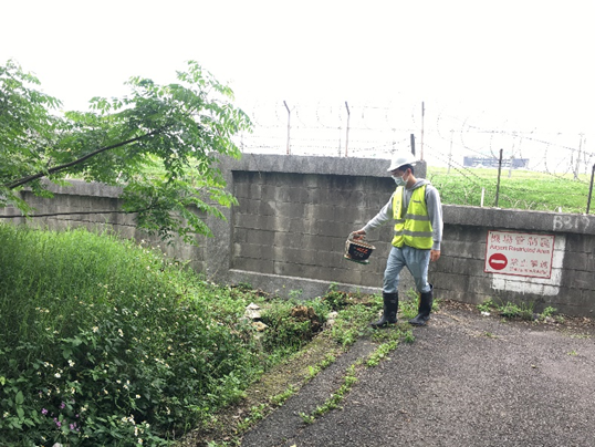
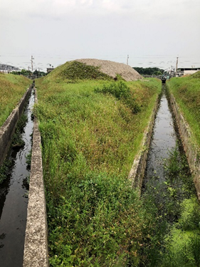
Taoyuan International Airport is located in the Dayuan District. In 2004, Taoyuan International Airport determined that the area around Taoyuan Airport, the airport traffic lane, and some parts of the lawn that divide the running chute were invaded by RIFA. The project team has achieved remarkable results after years of prevention and control work. The entire airport area has been lifted from the list management by the government in May 2018. However, because Taoyuan International Airport is located in the Dayuan District of Taoyuan City, and the current RIFA population distribution and density in the district is still relatively serious, Taoyuan International Airport is still in an area susceptible to RIFA recurrence. Sporadic ant nests are frequently detected in some lawn areas of the airport, which are related to the watercourses, drainage ditches, lawn water, and boundary walls in the airport. Heavy rains or typhoons have caused the water levels in rivers and streams outside the airport to rise rapidly, and RIFA enter the ponding lawns of the drainage ditches in the airport from the outside through the waterway system. The Airport RIFA Office has labelled and managed the waterways and drainage ditches in the airport and strengthened the detection operations after typhoons and heavy rains, related event photos as shown in Figure 1.
|
|
|
Figure 1. NCUE Taoyuan International Airport RIFA Control Team has strengthened fire ant control work in the airport’s drainage channels |
Link for reference information: https://www.facebook.com/NCUEEEC/videos/a.1053897732014001/549273452851485.
2. 24-, 33-Hour Courses for Environmental Education Personnel Certification:
The Environmental Education Center (EEC) nurtures relevant environmental education talents and. In conjunction with the project “In-Depth Cultivation of Fangyuan, Working Hand in Hand with Dacheng: Industrial and Environmental Sustainability Plan of the Two Townships of Changhua County” project, EEC provided relevant education courses for the local and nationwide communities from July to August 2022, and related event photos are shown in Figures 2-3.
Table 2. Environmental education course activities
|
Educational activities |
Time |
Number of students |
|
Environmental Educator 24-hour Certification - Dacheng Junior High School Class |
August 2022 |
13 |
|
Environmental Educator 33-hour Certification Class |
July 2022 |
27 |
A total of 40 educators were trained in environmental education and freshwater ecosystem maintenance.
|
|
|
Figure 2. Environmental Educator Certification for Dacheng Junior High School Class |
|
|
|
Figure 3. In-class learning of the Environmental Educator Certification 33-hour Class |
Links to course video information:
https://www.facebook.com/media/set/?set=a.636923044887728&type=3.
https://www.facebook.com/media/set/?set=a.636918504888182&type=3.
3. Project of the Division of Science and Technology: “Discussion and Solution Strategies on the Ant Infestation Problems in the Qianshan Caused by the Impact of Climate Change on the Ecology of Qianshan and the Changes in the Community”.
Natural disasters on slopes arose from climate change and man-made development pressure have caused landscape fragmentation, ecological fragmentation, and habitat loss, causing slopes in Qianshan, an ecologically fragile area. In addition, emerging ant infestation problems have appeared in Qianshan towns in south-central Taiwan. Ants pour into houses like streams, and flying ants invade homes like black mist. Such abnormal ecological responses warn of the gradual loss of the ecological health in Taiwan. This project integrates multiple domains. It takes the ant infestation problem of the Qianshan residents as the starting point to comprehensively examine the hidden landscape fragmentation, ecological loss, and development pressure behind the ant infestation problem. Using the ecosystem service on the slopes as the research framework, this study investigates key biofacies in the habitat, analyzes landscape changes, establishes indicators, and examines environmental fragility and ecological potential. In addition, in response to the logic of the impact of the ant infestation problem on the industry and tourism in the mountain village communities, a Qianshan agricultural production system with potential for ecosystem services and human well-being are established taking climate change as the background. Related event photos are shown in Figure 4.
|
|
|
Figure 4. Online meeting for discussion of project execution progress |
Link for reference information: https://www.facebook.com/media/set/?vanity=NCUEEEC&set=a.1053897732014001.
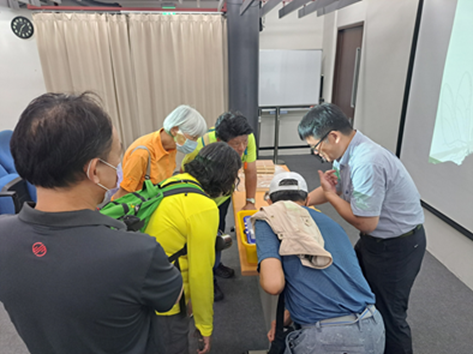
4. Management Office of Hualien Forest Zone, Forestry Bureau, Council of Agriculture: “Entrusted Professional Service Case for Ant Investigation Project in Danongdafu Forest Park”.
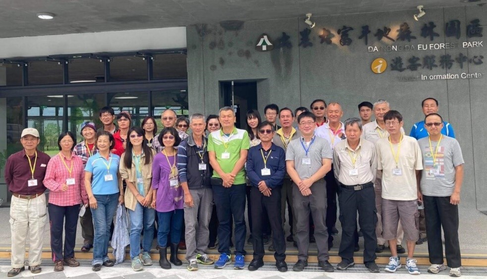
This project aims to conduct a full ant survey project for the Danongdafu Forest Park. Through standardized survey methods and habitat analysis, this project understands the ecological role ant colony structures play in forest development under the aforementioned management on flat terrain. Furthermore, instead of using ants as biological indicators, the ecological function groups of different ants can be analysed to understand the environmental conditions of Danongdafu Forest Park. The research results of ants in the Danongdafu Forest Park are integrated into the activities and curriculum planning of environmental education, designed considering the role of ants (Environmental Education and Training Course for Ants in Flat Forest), as well as environmental education promotion materials (Environmental Education Manual and Environmental Education Folded Flyer for Ants in Flat Forests). Related event photos are shown in Figure 5.
|
|
|
Figure 5. Educational Explanation and Study of Ant Environment in Danongdafu Forest Park |
Link for reference information: https://reurl.cc/MyL353.
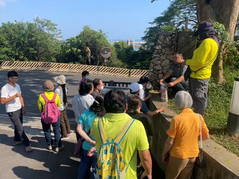
5.Project of Kenting National Park: “Yellow Crazy Ant Invasion Status Investigation and Control Strategy Research in Kenting National Park”.
This project assists Kenting National Park in investigating the invasion of Anoplolepis gracilipes (commonly known as yellow crazy ant), one of the world’s top 100 harmful invasive species in the distribution hotspots of land crabs (Houwan, Banana Bay, Barrier Island, and Yungchuan port). Furthermore, cooperating with the Taiwanese, land crab research expert Dr. Liu Hung-Chang used the data analysis of the number of female crabs during the breeding period when female crabs release eggs as the sea level lowers. Dr. Liu found that the invasion of Anoplolepis gracilipes is closely related to the decline of the land crab population, which has severely impacted the survival of the native land crab population in the Hengchun Peninsula. It has also been found that in areas with high human disturbance (such as farmland, farmhouse, forest edges, or fishing ports), the number of Anoplolepis gracilipes is significantly higher. Nesting close to man-made buildings allows members in the ant nest to obtain various resources, such as food, nesting space, and irrigation water. In addition to highlighting the importance of preventing and controlling Anoplolepis gracilipes, this project also provides suggestions on prevention and control. In addition to traditional chemical control, habitat restoration and removal of objects that can be used for nesting by Anoplolepis gracilipes seem like possible control measures, because they will not only increase the habitat suitable for land crabs, but also hinder the establishment of the colonies of Anoplolepis gracilipes. In view of the impact of Anoplolepis gracilipes on the ecological environment, ant control is a long-term work that must be continued to reduce the probability of land crabs being “killed by ants”, thereby maintaining the biodiversity in Kenting National Park. This project also organized a Yellow Crazy Ant Prevention Workshop in Kenting National Park. Related event photos are shown in Figure 6.
|
|
|
Figure 6. Yellow Crazy Ant Prevention Workshop in Kenting National Park |
Link to reference information: https://www.facebook.com/NCUEEEC/photos/a.1053897732014001/1053898902013884.
6. National Nature Park Headquarters Project/Investigation, Monitoring, and Control Plan for Long-Legged Ants in Shoushan National Nature Park:
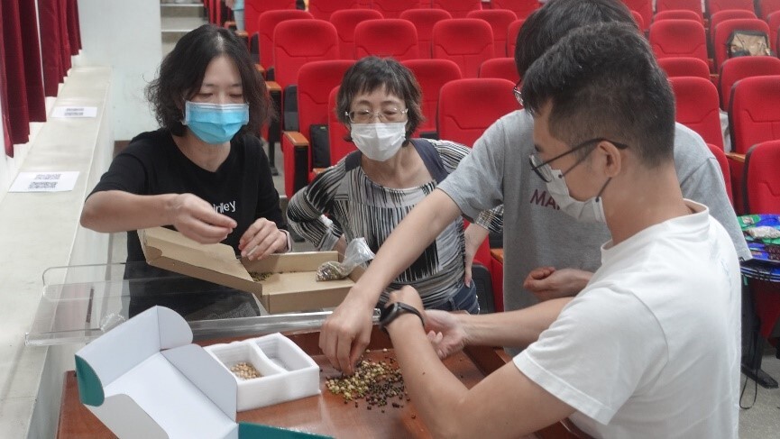
The coastal mangroves of Shoushan National Nature Park in Kaohsiung and the Qijin Seawall serve as crucial land crab habitats. However, in recent years, the long-legged ant (Anoplolepis gracilipes Smith, 1857), commonly known as the yellow crazy ant, has been spotted. In the land crab survey project of 2018, it was found that the yellow crazy ant had invaded wetland land crab hotspots. This invasive species of alien ants has been reported to cause severe ecological harm in invaded areas, such as Christmas Island in Australia and numerous Pacific islands, especially impacting the survival of local native land crabs. In 2020, a baiting method was used to investigate the distribution and density of yellow crazy ants in three land crab hotspots in the coastal areas of Shoushan National Nature Park in Kaohsiung and around the Qijin Seawall. The results revealed the presence of yellow crazy ants in all three land crab hotspots, with the most severe infestation occurring in the windbreak forests surrounding the Qijin Houshan Seawall. In the “Shoushan National Nature Park Yellow Crazy Ant Artificial Bait Station Control Project” in 2021, further investigations were conducted to examine ant nests in the windbreak forests surrounding the Qijin Houshan Seawall, where the density of yellow crazy ant populations is higher. The results revealed that the yellow crazy ants in Qijin Houshan had already formed a super colony. In this year’s (2022) project, it has been proposed to conduct liquid bait and insect growth regulator-type bait treatments in areas with high density populations of yellow crazy ants in the windbreak forests surrounding the Qijin Houshan seawall. Monitoring is being carried out using artificial bait stations and bait surveys to assess the effectiveness of control. In addition, distribution surveys of yellow crazy ants are conducted in land crab habitats in the Banpingshan and North Shoushan Military Restricted Zone. Long-legged ant control education and training courses for volunteers were held, and related event photos are shown in Figure 7.
|
|
|
Figure 7. Artificial bait boxes for yellow crazy ants in Shoushan National Nature Park |
7. Using LiDAR Point Cloud in the Forest and Hyperspectral Data to Analyze the Spectral Characteristics of Terrain and Build a Canopy Elevation Model:
From an ecological perspective, forest ecosystems have multiple functions, including provisioning, regulating, supporting, and cultural aspects. However, the value of forest ecosystem services can be influenced by changes in forest cover or structural composition. In this regard, the Research Center for GIS and Disaster Prevention at NCUE is conducting a project commissioned by the Taiwan Forestry Research Institute titled “Using LiDAR Point Cloud in the Forest and Hyperspectral Data to Analyze the Spectral Characteristics of Terrain and Build a Canopy Elevation Model.” The project aims to integrate various remote sensing materials and technologies for forest cover, forest type composition, and structural assessments. By utilizing multiple remote sensing techniques, the project aims to develop automated forest type interpretation models. Through on-site forest surveys, it will verify the accuracy of results derived from different scale remote sensing methods. The goal is to provide comprehensive information about forest resources, to enhance understanding of the benefits and economic value of forests, and to plan for the protection and sustainable use of forest ecosystems. This research will contribute to a more holistic understanding of forest resources and their sustainability, which can aid in better forest management and conservation practices.

